Map comparison assignment
Both London and Paris represent primate cities of their respective states- England and France respectively. London is synonymous to Paris with respect to spatial structuring and land use patterns. On focusing the map of London (figure 1-9), it is apparent that the city is located centrally enhancing its influence on the entire state with ease.
To bolster its influence the city is served by radial rail and road networks that spread to its rich hinterland. The core of the city otherwise the CBD that is characterized by congested neighborhoods transition outwardly to sparsely populated suburbs. To date, the evolving business centers around London are competing with the CBD.
Akin to London is Paris which is characterized by its central location vis-à-vis other cities within the state. Paris forms the core and, sits at the helm of power influencing the entire state. Even though it is located in less productive region, its hinterland, rich agricultural land is the reason behind its success.
Road and rail network which spread radial from the CBD facilitates its influence. However, just like London emerging urban centers on the peripheral of the state rival Paris. One such city is Lyon which is still being dwarfed by Paris in terms of population density (Kimble 492).
Both figures (fig. 1-3 and G-10) are meant to locate the modern European geographical realm and its origin. However, the accuracy of the information given about the origin of the states by both maps does not coincide in some aspect and, to some extend differ in the actual boundaries.
With regards to the origin, while figure G-10 owe the existence of powerful western European states to a rich agricultural hinterland, figure 1-3 owe this to accumulated minerals. With regards the boundary, while the absolute location of Europe is defined by high and upper-middle economies that stretch to Eastern Russia, the relative location of Europe (fig. 1-3) is limited to few states.
According to figure 1-3 the Arabic realm stretches deep within states located towards Iberia. To this end, it is evident that with varied views a map projection meant for the same location can differ in many aspects.
The boundary of Europe’s core area cuts across several states that include Southern Norway, Sweden, Poland, Slovakia, Austria, Slovenia, Italy, Spain, Ireland and United Kingdom. The boundary encompasses states that fall within regions defined by high income economies.
This is depicted by map G-10 that defines states and economies. Also, as portrayed by figure G-9 these are regions that are well endowed with industrial minerals and hence support large populations of persons. With regards to climatic condition (figure G-8) this core area is characterized by short dry season with average rainfall between 100-200 mm per annum as portrayed by figure G-7(Schaefer 279).
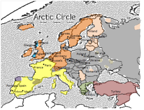
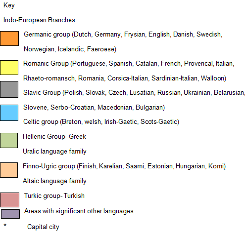
Europe as a geographical realm is a composite of many languages that fall within several groups. However, the discrete components of the groups are not mutually understandable. In turn, this has been an impediment to efforts geared towards unifying Europeans. However, on focus to United Kingdom English as a language spoken by the three states of Scotland, Ireland and England is the reason behind the existing peace.
Similarly, Switzerland enjoys a peaceful co-existence with its neighbor the Germans for the reason that they both speak Germanic language. This also applies to the Belgians of whom majority speak Germanic akin to its neighbors. The Polish who fall under Slavic group have pockets of Indo-Iranian groups that initially differed with both the Russians and the Germans to form an independent state- Poland.
Finland enjoys a peaceful co-existence with its neighbors thanks to a common language apparently spoken by most of its neighbors. Finally, Romania, an Island, is characterized by a single language- Komi vital in enhancing unity (MacLeod and Jones 507).
Map construction
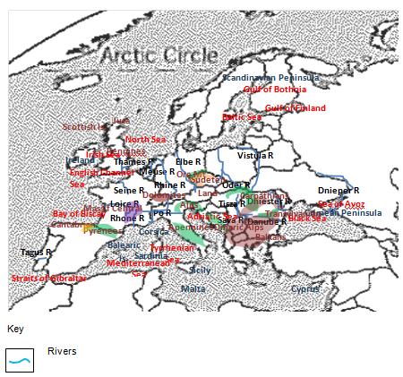
Map 1: showing Europe’s physical geography

Map 2: political-cultural geographic information.


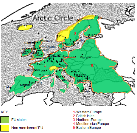
Map 3: Economic-urban information

Works Cited
Kimble, Hebert. “The Inadequacy of the Regional Concept” London Essays in Geography 2.17 (1951): 492-512. Print.
MacLeod, George, and Jones Mother. “Renewing The Geography of Regions.” Environment and Planning 16.9 (2001): 669-695. Print.
Schaefer, Frankline. “Exceptionalism in Geography: A Methodological Examination.” Annals of the Association of American Geographers 43.3 (1953): 226-245. Print.