Introduction
LIDAR is an abbreviation which stands for Light Detection and Ranging. Light Detection and Ranging is among the modernized technological systems that have gained major fame in the recent decades as a method of examining the conditions of the earth’s surface. This technique involves the use of a remote sensing system that is widely applied in the approximation of the distances to and from particular points on the earth’s surface (Hodgson et. al. 2003). An expert operating the system achieves accurate data from the entire exercise through an illumination of targeted points using laser light (Beniston, et. al. 1990).
Description
Other than archaeology, the Light Detection and Ranging is predominant in many fields, some of which include seismology, geology, forestry and geomorphology (Hodgson et. al.2003). This paper, therefore, presents a discussion of a site, analyzes various critical comments of the site’s interpretation as well as provides an understanding of various types of landscapes. In addition, the discussion also provides a comparison between the site description and other sites within the region through the use of diagrams and illustrations.

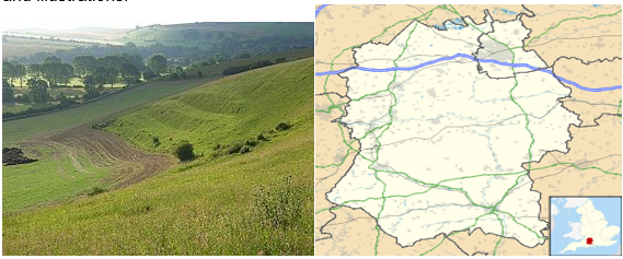
To begin with, the Ebsbury is situated on a grid reference of SU061354. This site as such is located to the western side of the village of Wishford. There also exists a summit linked to the hill of Ebsbury which has a height of approximately one hundred and seventy five meters (175 m). In addition to the summit, there lies the site of Grovely castle, which is situated to the West of Ebsbury. Furthermore, Ebsbury neighbors one of the largest forests in the Wiltshire known as the Grovely Wood. In a more specific identity, the site is situated in the St. Martin parish, Barford in the famous Wiltshire (Rosso, Austin, & Hastings, 2006).
Ebsbury as a site is composed of files systems, enclosed systems of the Romano-British settlements and the Iron Age, as well as the hill fort (Hodgson et. Al. 2003). An individual taking a closer look at the current scenes of the site (Ebsbury) would take a note of the conspicuous ditches, even though these ditches are no closer to completion (Beniston, et. al. 1990). It is also evident that there had been a series of agricultural activities, which were conducted by the initial inhabitants, thus leaving behind observable earthworks.
Along the hillside, one would also observe E-shaped landmarks which attracted much interest. Contrary to the initial archaeological evidence a current evaluation of the site would evidently reveal the presence of Dew ponds as new features (Beniston, et. al. 1990).
Further observations and evaluations reveal the presence of three 6 foot ditches that occurred in parallel to each other. Closely situated to the parallel 6 foot ditch, where other several ditches (0ne hundred Yards each) have no agricultural function, nor any military functions. Lying to both the Eastern and the Northern sides of the site, there occur the contours of the hilly region. These contours have an embankment from multiple banks (Hodgson et. al. 2003).
The Eastern end of the site is also occupied by yet another site characterized by an initial Iron-Age settlement. Presentations being a better percentage of the Ebsbury, serve as a reserve of nature, whose access remains more possible through a track made for the Wishford Cemetery. On the other hand, the west of the site occupies the Grovely Castle that occupies the subsequent spurs. The Grovely Castle is clearly defined and bears a distinction from the other features related to the site through a steep valley (Hodgson et. al. 2003).
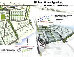
The process of conducting a site analysis entails a redesigned research activity that an individual carries out with a main objective of gaining knowledge of the site. This is for planning purpose of both future and current use (Beniston, et.al.1990). There are a number of elements that are considered in a successful analysis and the interpretation of a particular site (Hodgson et. al. 2003). Among the elements are the location of the site, zoning options of the site, neighboring or related sites, as well as the existing natural and man-made physical features such as landmarks (Beniston, et.al.1990).
In addition to the components of nature, one would also consider the role of climatic components, both private and public utilities, utilities and their circulation for a critical analysis of a site. For instance, if an analysis of Ebsbury as a site would be considered, then the use of LIDAR techniques would prove as a vital tool for the entire process. In this case, an aerial view of the site would reveal the presence of major landmarks in existence (Beniston, et. al. 1990).
Ebsbury appears to have a closer relationship with not only the already existing landmarks, but also with the other sites in the neighborhood. Related sites and features include the hill contours, the famous Grovely Wood and the Grovely Castle (Hodgson et. al. 2003).
Site analysis would also consider the neighborhood context. Information regarding the neighboring features and sites would also be obtained through the use of LIDAR techniques. The use of Light and Detection technologies in this case would facilitate direct observation of the necessary features. In the case of Ebsbury, the green vegetation depicts an environment of cool climate that widely spreads across to the neighboring sites (Beniston, et.al.1990).
There occurs a series of contours across the hill. This is an indication of the initial activities such as agriculture which might have taken place during the earlier periods. The illustration below shows the use of the LIDAR technique in the site analysis of Ebsbury (Rosso, Ustin, & Hastings, 2006).

It is of utmost importance to acquire a deep comprehension of a site before any site analysis criteria commence (Beniston, et.al.1990). This, therefore, requires one to gain adequate knowledge of the type of landscapes that predominates that site (Rosso, Ustin, & Hastings, 2006). Among the various types of landscapes one is likely to deal with there is glacial lakebed, ground moraine, valley wall, valley floor as well as the protected slope. However, this presentation reflects majorly on the protected slopes, valley floor and the valley ridge (valley wall). These features majorly occur as components of foothills, highlands and in the natural forested regions (Rosso, Ustin, & Hastings, 2006).
Conclusion
As a wrap up, therefore, Ebsbury compares and contrasts well with other neighboring sites or other sites within the region. The vegetation depicted in the site is also observed in other neighboring sites. Such neighbors include regions surrounding Newton Falls, Willard and Solon. The green vegetation depicts the cool equatorial climate that is predominated with regular rainfall. However, the site has unique distinctive features that separate it from the neighboring sites. Such distinctive features include the occurrence of contours along the hill which may also be archaeologist to determine the kind of activities that may have taken place during the initial periods of history.
Reference List
Beniston, M., Wolf, J. P., Beniston-Rebetez, M., Kölsch, H. J., Rairoux, P., &Wöste, L. (1990). Use of lidar measurements and numerical models in air pollution research. Journal of Geophysical Research, 95 (D7), 9879-9894.
Hodgson, M. E., Jensen, J. R., Tullis, J. A., Riordan, K. D., & Archer, C. M. (2003). Synergistic use of lidar and color aerial photography for mapping urban parcel imperviousness. Photogrammetric Engineering and Remote Sensing, 69 (9), 973-980.
Rosso, P. H., Ustin, S. L., & Hastings, A. (2006). Use of lidar to study changes associated with Spartina invasion in San Francisco Bay marshes. Remote Sensing of environment, 100 (3), 295-306.