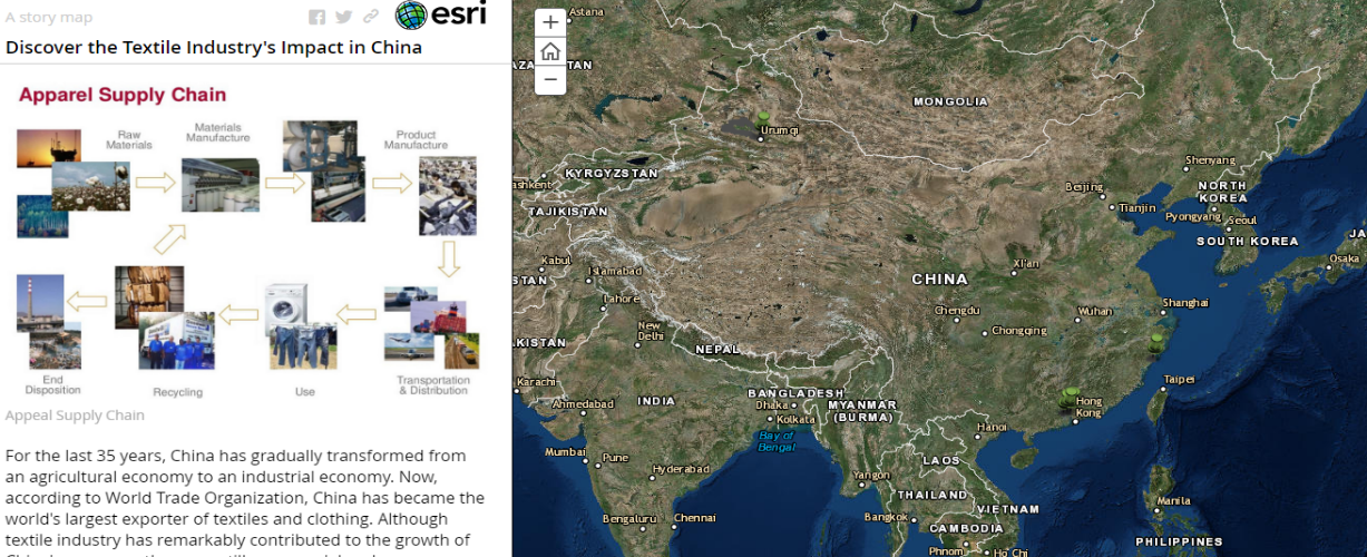
Introduction: Importance of the Textile Industry in China and Its Environmental Effects
Nowadays, China remains to be one of the main and largest exporters of textiles and various clothing in the whole world (You, Cheng and Yan 33). The industry makes the employment of more than 13% of the Chinese population possible. Still, it is necessary to comprehend that in addition to a number of positive aspects of this industry, plenty of downsides can be observed covering the environmental and social issues. It happened that my family had been involved in the textile industry for the last 25 years. I know that many people enjoyed the benefits they get from the quality of the industry and the products offered. At the same time, I know that certain issues such as child labor and environmental hazards cannot be ignored. It is expected that some changes have to be made immediately, and people should hear the information and realize their importance in the system.
Many methods may be used to cover these issues and underline their importance, and geovisualization is one of the approaches that can be offered to explore what is already known and remains to be unknown. Geovisualization and deep mapping help to represent the places in all their untidiness and complexity (Warf 134) and introduce the topic from its most captivating side. It seems that people are eager to accept and comprehend the textual information better in case some visual examples, proofs, and facts are added. Therefore, the main goal of this report is to prove that visualization, in this case, in the form of the ESRI Story Map Journal, is one of the best options to tell personal narratives about the textile industry in China, to underline the challenges people may face in case the textile industry cannot be improved, and to explain that the picture that an ordinary citizen is observed getting their clothing or other products that are the results of the textile industry is not as perfect as it seems to be.
Literature Review: China’s Textile Industry: From Words to Maps

The question of the worth of emotional aspects of cartography has been raised by a number of writers and researchers. They want to prove that the use of maps and cartographic technological can be defined not only as a pure technological tool but also as the tool that can be used “to counter imperial logic and to elicit differently, but equally valid, kinds of emotions” (Craine and Aitken 149). In this project, the use of maps in order to tell more about the positive and negative aspects of the Chinese textile industry has several clear reasons. First, this method helps to introduce the place in terms of which the industry is discussed. Second, the chosen method underlines the main points that are going to be discussed. Finally, this approach helps to “move beyond the critical trend for which the map is a unifying and totalizing concept, produced by a distant eye” (Bruno 207). On the one hand, such a method introduces the territory that has to be discussed because of certain reasons so that the reader observes the scales and the size of the possible problems or benefits. In other words, a kind of “emotional punch” in regards to the reader is observed (Craine and Aitken 154). On the other hand, the textual information, the facts, and the numbers can be used to prove the importance of the chosen topic and to explain why a particular territory is chosen for the analysis. In other words, it is possible to identify “the space between our conscious knowledge of our bodies and the borders of the map” (Craine and Aitken 154).
Description of Data: Mapping as a Chance to Gather and Introduce Information in the Most Effective Way
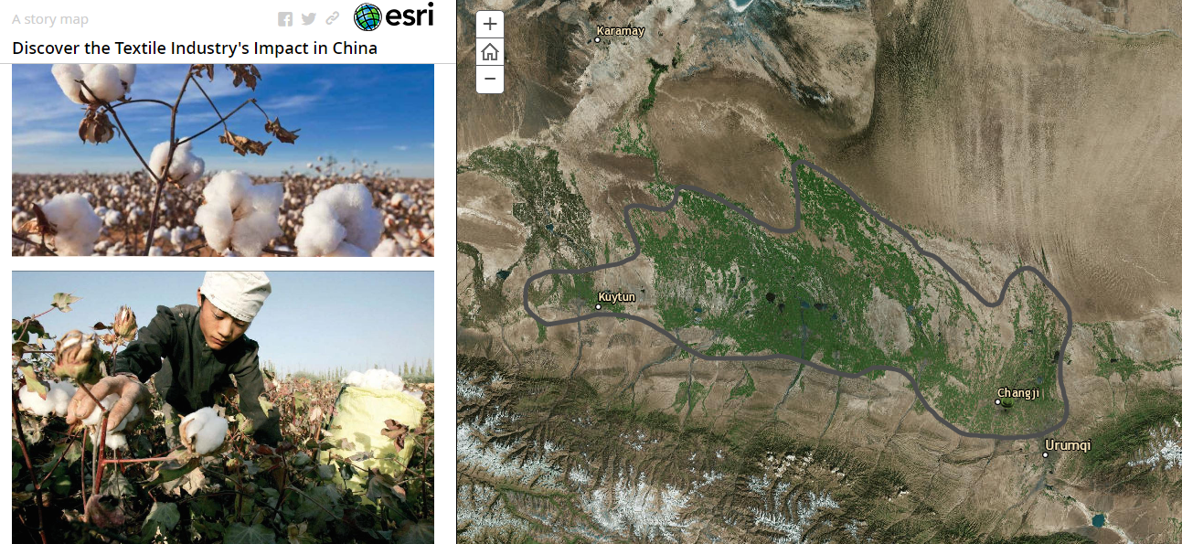
Mapping and visualization are crucial and effective means to share information. Still, to create such an effective source, a number of steps and details have to be taken into consideration. There are several sources of information that are required to create the project. First, it was necessary to choose the tool within the frames of which it was possible to introduce the information. ESRI Story Map Journal was the method that helped to unite the textual information with maps and other content that could be interesting and educative to the users. It included the geographical location of the territory that was under the analysis, several photos to provide visual evidence of the topic and its urgency, and the text that was gathered from different online and library sources. The text was taken from research developed in the textile industry and its current situation in China. Several articles were found online, several personal observations and thoughts were taken to strengthen the project, and several reports were used to prove the existence of the problematic issue. It was necessary to introduce the problem, show its actual scope, and explain why people had to pay more attention to it. It was not enough to give dry numbers or facts. It was more important to show the industry from the inside and prove that children were involved or the environmental hazards occurred.

Deep Mapping: Mapping Process that Helps to Comprehend the Essence of the Textiles
Story Map is the method chosen for the introduction of the material. Several steps were taken to create the project:
- The creation of the account and the validation of the link that was sent via e-mail;
- The creation of a Web App should be available to “Everyone”;
- The choice of a Story Map Journal and the creation of such details as “Title,” “Tags,” and “Summary” was done;
- “Side Panel” was chosen as the main model with a clear title identified “Discover the Textile Industry’s Impact in China”;
- “Map” was chosen as the main stage content;
- “Side Panel Content” was filled with images and text that could be added following the guidelines offered in the app;
- The next pages were created the same way; and
- The “Save” button was clicked to complete the project.
Each step and button clicked had its own goals. First, it was necessary to introduce the area and prove that there were enough grounds to start discussing the topic. Then, it was important to give clear images and facts to the problem under discussion. Finally, it was crucial to explain the necessity of new steps and their possible effectiveness.
Critical Reflection: Impressive Size of the Industry’s Impact
One of the most impressive things observed during the creation of the Story Map was the possibility to observe the actual sizes of the industry and its impact on China. It seemed to be that “Ah-Ha” moment of the whole work. This project helps to comprehend that the textile industry of China is impressive indeed, and each step taken by all stakeholders is an important decision that has its goals and impact on human life. The necessity to identify certain places was a challenge in the project because clear facts were required. Still, it was interesting to find such places and united them in one great picture. In general, the outcomes and the creating process show that China has a huge potential to develop the textile industry and improve its impact on the Chinese people and other nations involved in the industrialization process.
Works Cited
Bruno, Giuliana. Atlas of Emotion: Journeys in Art, Architecture, and Film. New York: Verso, 2002. Print.
Craine, Jim and Stuart C. Aitken. “The Emotional Life of Maps and Other Visual Geographies.” Rethinking Maps. Ed. Martin Dodge, Rob Kitchin, and Chris Perkins. New York: Routledge. 149-166. Print.
Warf, Barney. “Deep Mapping and Neogeography.” Deep Maps and Spatial Narratives. Ed. David J. Bodenhamer, John Corrigan, and Trevor M. Harris. Bloomington: Indiana University Press, 2015. 134-149. Print.
You, Sauwai, Stephen Cheng, and Hong Yan. “The Impact of Textile Industry on China’s Environment.” International Journal of Fashion Design 2.1 (2009): 33-43. Print.