Introduction
The quality of life lived can always be enhanced through very many ways within society. One of the ways to nourish relationships within families or amongst individuals is participating in leisure activities such as making a holiday trip. Development of tourist cities and leisure centres ought to consider all individuals including those who are physically challenged. Tourism destinations all over the world should consider the creation of barrier-free tourism which would accommodate people of all walks of life. People with physical challenges should be incorporated into the design of pedestrian roads and heritage square. Tourism involves lots of leisure activities including travelling which creates new life from ordinary life through the encountering with new cultures. People from all walks of life have a desire to enjoy travelling to tourist cities and participate in various leisure activities which enhances self-esteem as well as assisting in social adjustment (Scott 2000).
Urban designing is defined as the art involved in designing places for the purpose of settling people. The design method presents one of the most important elements of urban planning. The planning process entails various aspects such as the aesthetic value of building masses based on the intended functions. In addition, enough passage areas are constructed to enhance an easy movement of both people and vehicle traffic. This would improve the communication links within the towns. Urban planning and design incorporate visionary frameworks which project quality outlook of the development formats capable of accommodating vast developmental activities and at the same time maintains socio-cultural activities (Susan and John 2004).
Development of modern quality attraction centres in Hong Kong requires the use of upgraded technology capable of producing modern designs and at the same time maintaining a sustainable environment. The aim of this research focuses on scrutinizing the available urban design methods and ultimately advice the general public on the preferred designs capable of maintaining the aesthetic value of the natural environment. Infrastructural development does not entirely define an urban metropolis; it is also defined by the expectations and ambitions of its habitants and characterized by its upsides and downsides.
The Cities background, practices and communal set up form the core of the city’s existence. There is a need to effectively administer the city’s populace, community and academic resources. Effective management will portray the administrators’ ability to initiate exclusive strategies for growth, which should involve the population and focused on alleviating poverty. The political dispensation needs to be improved and the corresponding reorganization of the societal set up achieved. All available capital should be called to use so as to uphold a well-balanced growth. Whatever the methodology employed to attain these objectives should encompass the following precedence; discrepancies that exist in the population, dissimilarities in the metropolis, ecological perils and the city’s development (Scott 2000).
Urban planning and the environment should be in correspondence. The infrastructure should encourage environmentally friendly means of transport. There should be enough room to accommodate pedestrians and bicycles in essence reducing air contamination from fumes emanating from motor vehicles. “The value of human life is elevated with good urban planning that reflects accountability and far-sightedness on the side of the administration. The global benchmark advocates for the provision of clean water, observation of hygiene, permanent housing structures and adequate room to reside”. These factors constitute a good living environment. The administration should concentrate its efforts on making all services accessible to the whole populace, using environmentally friendly and alternative fuels and ensuring the city’s environmental impression does not cross outside its boundaries (Scott 2000).
Background Research
Several barriers within tourist cities could hinder travel activities towards various centres. Access has been considered as one of the most important aspects within tourist destinations where facilities, as well as information, are available to all. Hong Kong is anticipated as one of the Asian countries expected to experience steady growth on tourist arrivals, the city is expected to receive over fifty million visitors within the next fifteen years. However, the question still lingers on how the city environment will be able to accommodate such a number of tourists. This poses a challenge in the planning department since they are required to design methods which would enable the industry to develop responsibly and in a sustainable manner. The level of pollution and exhaustion of the environment determines the nature of the carrying capacity within the destined area. Statistics reveal that within the current time Hong Kong receives approximately 15 million visitors. Despite the growing number of visitors, the government has placed little consideration on developing sectors meant to overcome the demands placed upon the environment (Scott 2000).
One of the major tourist attractions in Hong Kong Disneyland is expected to attract over five million visitors with the next couple of years. Disneyland generates a considerable amount of revenue for the economical benefit of the country. The theme parks also placed a considerable impact on the economy of the country. The paper focuses on the extent to which tourist attraction centres and the nature of pedestrian streets might affect the sustainable development of Hong Kong’s tourism industry. Secondary data would be collected from internet sources and already published literature. The analysis would then be done as well as discussion using appropriate methods whereby final insights concerning tourist destinations as well as appropriate balance within the sustainable development would be drawn(Scott 2000).
Background of Hong Kong Tourism
The tourism industry has developed in Hong Kong for approximately the last fifty years. The superior geographical location of Hong Kong made it easier for tourists to perform their shopping activities in the area owing to free trade as well as favourable business policies such as low tax rates. The open-door policy of China in the 1970s and 1980s created easy access promoting the increase in the number of inbound tourists in the early 1990s. However, the rate of development of tourism industry slowed down in the late 1990s due to recession and terrorist activities. The rise was again experienced in the year 2004 despite the threat of contagious diseases such as SARS. Great competition has since existed from other rising Asian cities, creating the need for aggressive tourist marketing activities all over the world.
There is widespread long-haul growth spearheaded by high economic growth, strengthening of European and other currencies, rejuvenation of confidence in tourists especially those of American origin and thorough marketing activities. Low-cost air travels within Southeast Asia connecting through Hong Kong has made it attractive inexpensive for most tourists. The development of infrastructure such as well established carriageways improved visitor experiences within long and short-haul market environments.
However, China mainland contributes the majority of visitors to Hong Kong. Frequent visits by tourists were encouraged by the introduction of Individual Visiting Scheme (IVS), which enabled individuals to travel freely without a specialized visa. The total percentage of tourists from North Asia grew considerably with various countries such as Korea, Malaysia and Singapore following the influx. However, all other key tourist destinations within Asia revealed a strong growth over the last ten years (Scott 2000). Owing to such competition from neighbouring countries, Hong Kong requires continuous up-grade within its facilities and services including quality branding. This called for strategic marketing plans capable of addressing the changing trends within the global markets. The strategies should be flexible enough to accommodate both native and international tourists.
Research questions
Is it a better or sustainable way to development to spend on Tourist Street, Pedestrian road and Square in tourist and developed cities? The idea of sustainability (Social‐Environment‐Economic) has got the ability to define the nature of the tourism pedestrian road, (the relationship between pedestrian, tourists, vehicle, Green, business, environmental design and furthermore heritages protection). The question focuses on how to give a balance between tourism development, social responsibility and environmental sustainability. Not only green, but it’s the function behind – In the different perspectives of the public’s facility user; how to keep Tourist and Road user walks rely on foot? Is it a way to reduce the criminal case? How should the government achieve the ideal environment for different users along the streets?
Objectives
The tourism industry is a hot issue, especially in China; lots of potential tourist city are either under-developed or in the process of developing. Pedestrian road and heritage square become an image and a tool of a city for tourist. In most of the case in a developed city, the overlap between the tourist attraction, heritage spot and city centre traffic roads are familiar.
- To sum up a suggestion of improvement and development base on the following research objectives from different case study:
- To identify and analyse the land use components, street’s components and heritage protection of a tourist city.
- To examine and compare the existing green street, a case study of successful cities.
- To investigate people‘s behavioural preferences towards, both citizen and tourist.
Theoretical Framework
Base on the idea and the theory of sustainability planning, reflect on the tourism pedestrian road and heritage square, to give a balance between environment protection under social and economic development.
Hypothesis
A comprehensive and ideal environmental planning on a tourism pedestrian road and heritage square is able to carry sustainability idea and development, more likely to enhance the city’s image and fulfil the different needs of the user. The development and the environmental protection of Tourism spot are possible to improve in a pair of parallel lines.
Literature Review
A large number of articles focuses on tourism development and the processes of developing and sustaining the various tourist destinations. However, further research reveals that few models focus on the processes of developing tourism within the various tourist cities. The necessity lies not in focusing on numbers but in explaining the major development processes which should be adopted. This requires a deep understanding of the nature of growth and the various changes in the tourist destination areas. The whole issue involves those in the tourism industry as well as those within the public sector since they provide the necessary infrastructure and at the same time have a major responsibility in environment maintenance to the required quality and safety.
The theme of the evolution of destinations is one of the major theme’s focusing on the development processes within tourist destinations. The destination life cycle model deals majorly with the development of tourist destinations (Butler, 1980). The model assisted in formalizing some recognized processes which have been in literature discussion for over twenty-five years (Prosser 1995, 3). According to Prosser, there are three main factors which have contributed to the enduring attraction of the concepts within the destination life cycle (Prosser 1995, 4). The model goes further to provide an understandable conceptual framework where theoretical approaches cannot be relied on.
Destination Life Cycle model
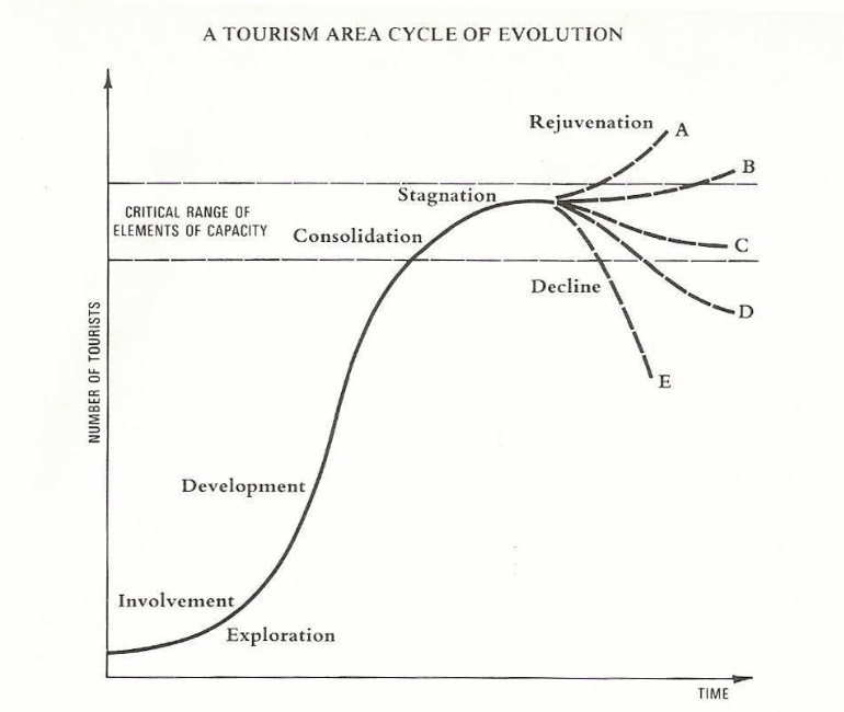
According to Plog 1973, similar processes are required for the development and upgrading of tourist attraction areas. The author suggests the various destinations on a spectrum based on the nature and types of tourists. He further gives an opinion on the expected changes within the market destinations in various forms which include types of tourists as well as potential numbers of visitors (Plog 1974, 58). While the rates of tourist growth might widely vary the consequent results might prove similar in every case.
According to Butler’s destination life cycle model, the sale of a product is considered to proceed slowly in the preliminary stages, and then followed by rapid growth rate which at times stabilizes and at times decline to lead to the creation of what is referred to as a basic asymptotic curve. This infers that basically, visitors come in small numbers at the initial stages majorly due to lack of crucial domains such as accessibility, facilities as well as local knowledge. Development of facilities as well as the knowledge leads to growth within the tourism industry. The level and nature of marketing determines the popularity of the tourist destination but would ultimately decline depending on the carrying capacity.
The carrying capacity of an area is determined through environmental factors, infrastructure and social factors. Environmental degradation resulting from over-use would eventually have a negative impact on visitors. The exploration stage is marked by a small number of non-local tourists attracted due to the destination uniqueness in nature and culture. This makes the level of contact amongst individuals as well as facilities high creating high significance levels to the tourists and at times the local residents. At some stage, the locals get involved in providing facilities primarily for visitors strengthening the relationship between locals and visitors. This leads to major marketing activities such as advertising meant to attract more tourists within a defined market environment.
Tourist seasons are preceded by various adjustments within the social pattern of the natives who are deeply involved in tourism. At some point, the government assist in making tourist travel arrangements such as upgrading access roads including the expansion of pedestrian paths. Then there is also the development stage within the model which represents a well-defined tourist market area. This will however be characterized by a decline in local participation in the control of development activities. This is since upgraded facilities with modern designs would be provided by private firms enabling high accommodation rates. Facilities would be upgraded to accommodate both cultural and natural attractions and at the same time giving room for man-made imported facilities. Such development would change the physical appearance of the destined area with either approval or disapproval of the local community.
Consolidation stage is characterized by the decline in the rate of tourists visiting an area. The stage also reveals that the total number of visitors is greater than the population of the local residents making tourism one of the major parts of the specified area’s economy. Marketing is the major activity within this stage where various efforts are made for the purpose of extending visitor season and marketing area. The stagnation stage, on the other hand, represents the situation where the full capacity of visitors is attained owing to full utilization of the available resources leading to the creation of environmental, social as well as economic problems. Available facilities will be fully utilized leading to repeat reliance on the same forms of traffic and social facilities hence strain in the maintenance of the level of visitation.
The various forms and areas of attraction would have been overwhelmed by the artificial facilities making distortion within the natural geographic environment. This encourages major change towards the organized groups of tourists. Stability stage may be reinforced by renewed growth and re-development. This would enhance the required complete change within the various attraction points. Such changes would involve adjustments to the carrying capacity levels and at the same time demand perpetual protection of the available resources. Then the decline stage is characterized by the areas inability to compete with other modernized new attraction centres making the area experience market decline due to its outdated facilities hence would only be preferable for short visits.
Despite all the discussions, one important aspect should be recognized within this area which entails the change of attitude. This aspect should be taken into consideration in the planning process involving tourist areas. Development of such areas should be kept within predetermined capacity limits with the upgrade being made and maintained for a longer period of time. More visitors should be catered for in the long-run instead of using the policies advocating for maximum short-term development.
Tourism Sustainable Development
Mathieson and Wall1982 discussed the complex nature of tourism and the various economic, physical as well as social impacts. United Nations declared the year 2002 as the ‘International Year of Ecotourism’ with an aim of consolidating all other diversified definitions and interpretations of Sustainability in tourism. World Commission on Environment and Development refers to sustainable development as the kind of development with future stakeholders in mind. The report underlined the various responsibilities which should be taken by the current generation in view of preserving future generations. Sustainable development incorporates the various economic activities since they affect the nature of tourist attraction centres since tourism is directly dependent upon the level of maintenance done on the natural environment.
Sustainable Development of Hong Kong Tourism sector
Most of the tourism sector within Hong Kong focuses on the resort which comprises Disneyland, theme park, two hotels; chain of retails, dining as well as vast entertainment facilities within one of the Island’s known as Lantau. Sustainable development involving Disneyland and other facilities requires updated proactive initiatives which could be for longer periods of time. All the initiatives need to be market-oriented rather than those which only follow trends (Ng 2004).
Macau Inner Harbour hosts the Chinese City that was urbanized at the same time as Christian City. Christian City also known as the western city offers benefit to the direct outer port. Chinese City accommodates Chinese migrants who through toil have developed homes around its beaches. The abundant shop house kind first developed in Macau before spreading to the Christian city. Nonetheless, the source of the Asian shophouse is still contested. It mushroomed across several port cities and further into cities in the mainland and in Chinatowns. The Asian shophouse domineered profit-making activity in the region (Jeffrey 1999).
There has been some activity pertaining to investigating the source of these shophouses. Ismail and Shamusddin focused their energies into studying the likely sources of the. The shophouses were modified in 1822 by Sir Stamford Raffles when he changed the structural design from a more open layout to a closed one. This design offered a shade on the pavement that would shelter the population from extreme weather. He developed a means to enable the masses to gain entry into the interior areas of the structure that not only hosted business premises but also homes. The British would later adopt new guidelines for construction that approved of tougher materials as a precautionary measure against fires. The new structures would now be constructed using blocks and would be crowded together to ensure durability. Different backgrounds merged together in the city of Macao to create an advanced fusion impacted additional metropolis (Pinheiro et al 2005, 2).

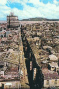
Rafle’s modified shop houses (San Ma Lou) still exists in Macao together with the ancient Chinese ones that were there before the modification thrive. These Chinese shops can be spotted in Chinatowns Happiness Street whereas the San Ma Lou can be spotted in Avenida de Almeida Riberio. This analysis seeks to establish differences between the old Chinese shops and the San Ma Lou. To date, there are no major alterations on the happy street which was considered a recreation hub. The structural design was borrowed from the customs of the Qing dynasty while observing the precautionary measures of using blocks to make the building stronger and devising fire exit routes. The structures hosted both business premises and homes with the lower floors reserved for the former and upper section reserved for the later. It is difficult to tell one from the other i.e. the residential from the shops. Various methods were invented to show the distinction and offer direction. Character signs were posted at the gates and some more were painted on walls (Pinheiro et al 2005, 3)
The houses had special structures to keep from extreme weather e.g. the Mother-pearl-windows and gilded-crafted screen divides. Conservation of the old houses in the street was mostly done by The Cultural Institute of Macau (IC). This is contrary to the situation as experienced with the San Ma Lou which has experienced deteriorating business activity a number of business premises of this typology being shut down and some of the structures have become shells. This paper will seek to examine ways in which there can be an invigoration of the San Ma Lou typology. It will seek to analyze the typology’s background and importance in the history of the city of Macao. The effects of the British building culture that improved the structural designed shall also be examined (Pinheiro et al 2005, 4).
Uses of houses
There are sufficient grounds that influenced the expansion of the elongated housing design. A number of refugees retreating from China owing to the Taipei Revolution made hygienic conditions deplorable and exposed its inhabitants to the risk of pandemics. Some of the refugees were seeking to take advantage of the thriving commercial conditions in Hong Kong. The Dempster Report that exposed deficient hygienic status in the city impelled the authorities to put into effect The Buildings and Nuisance Ordinances. An evaluation was carried by Osbert Chadwick that exposed the harmful consequences emanating from congested accommodations. In his study, he also proposed new rules to curb this menace. These essential alterations met with challenges including resistance by the privileged personalities in the society. They argued that the proposed structures would bring down the population and affect property owners leasing profits. They also contended that the new developments would affect the number of refugees seeking asylum. Macao experienced a huge arrival of migrants in the 1860s mainly at the Chinese Bazaar. A huge number of people were residing in vessels and engaged in trading activities in the metropolis (Pinheiro et al 2005).
Immigrants from Guangdong, Fujian and Hakka communities came looking for greener pastures in Nanyang. It was felt that the extensive shophouse typology could sufficiently house this group. Owing to the close proximity the clans were harmonized and organized themselves and as result, they gave birth to the Kong Shi a shared company. There were many functions developed for the shophouses. Other than being business premises and homes they provided a big room for the safekeeping of humans and merchandise. Around the time that slave trade was eliminated a substitute commercial venture was invented that involved dealing with collies. This was in the period between 1851 and 1874; a significant financial explosion was witnessed owing to the new trade. The immigrants preferred the unrestricted and packed harbour areas. Other factors that contributed to the commercial exploits of this city included betting and gaming, Tea business and the illegal sale of opium. The alien government could not easily administer areas that had been densely populated. The shophouses in these areas had formed a pattern that featured passageways and labyrinths that offered complicated access for the authorities (Pinheiro et al 2005, 5).
The Tradition of Long Buildings in Macao
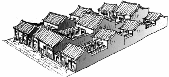
Kung Ian Tung and the Ling Fong are provided with the model and ritual of complex extended structures. The Ling Fong was characterized by a balanced expansion at each end of the central component. It had two corresponding passages minute entrances to the other sections of the building.
The Evolution of the Chinatown of Macau
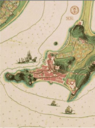
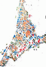
The ancient western fraction of Macau was developed at the same time as the latter’s Chinese City and Macao Peninsula. The western city is also referred to as Christian City. Rua Direita which stands for “Straight Street” in Portuguese was the central channel of interaction between the Ama temple and central old Christian city. The Christian City was built on the level ground in the direction of Praya Grande, the first outer port and was secured by the Camoens and Monte hill. The inner Port is opposite the Chinese city with the later facing Mainland China. According to Braiser 1972 maps, the inner Port and Outer port gave rise to the two cities. There exists a varied culture between the two cities that bear the resemblance of infrastructure and are linked at more than a few ends. Both the Chinese City and Christian City developed naturally without being preconceived, they followed the Portuguese middle age ideology of acclimatizing to the uneven landscape coupled with Chinese customs that had been affected by Fung Shui (Pinheiro et al 2005, 8)
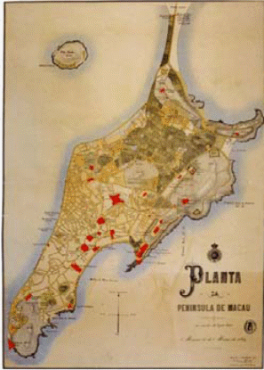
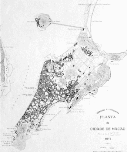
The building progress was however hindered by the collapse of the Mandarins reign in the city. This reign was disrupted by Governor Ferreira de Almeida who stood in the way of constructing additional structures. Challenges brought about by differences in customs and beliefs of various groups were eventually conquered especially in regions reserved for burials, uneven agricultural estates that were mostly rice-producing, provisional lodgings etc. Amaral was killed in the dispute arising from his intentions to enforce a “western” style metropolis and reign in Chinese territory. His death did not however stop the course towards a modern city. He left behind the blueprint and growth that would be carried on by his heirs (Pinheiro et al 2005, 8)
The deceased governor was viewed in a different light in various quarters. The Qing perspective was in a negative light, they described a devil, but in the Portuguese quarters, he was seen as a saviour. Amaral had amassed a wealth of experience working in the protectorates of Brazil and Africa. This experience was however of no consequence to the senate and the reigning Qing’s. The governor’s ability to exercise control over the graveyard area proved impossible, he also could not administer rice plantations. Amaral stirred animosity trying to enforce rules governing the building of additional structures. The financial status and ethical fabric of the city started to plummet as the buildings appeared to be in poor shape. The population of the city also decreased over time (Pinheiro et al 2005, 9)
Timer and straw was the most common structural design amongst the houses lying at the beach and those further ashore. The riverside was characterized by buildings made of timber. They were called the palafites and were previously used as vessels. Lack of a communal waste disposal system instigated the use of the river’s tributaries to dispose of human waste. This system generates a lot of stenches and gave rise to recurrent pandemics reducing the size of the population (Pinheiro et al 2005, 9)
The Mandarin Imposed taxes unfairly. The high population of the city coupled with the deficiency of a disposal channel makes easy floods of a combination of human and animal waste in water paths. The pitiful hygienic standards were the basis of recurring pandemics and facilitated fire outbreaks. There were wide-spread catastrophes owing to the hygiene crisis that was comparable to the same atrocities experienced in Hong Kong. In order to revive the fortunes of Macau Amaral tried to imitate Hong Kong which was vibrant at the time (Conim and Teixeira1998, 9). The governor opened up the military to absorb the youthful Macanese but most of the gifted ones left for Hong Kong and Shangai. He faced opposition from the senate whom he held in suspicion because of their approach towards the mandarins. It had become impossible for the governor to dig out the city from its myriad challenges. Amaral issued instructions for the names of every street to be inscribed in the walls thereby enforcing certain orderliness for policing and taxation (Pinheiro et al 2005).
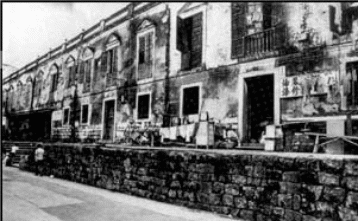

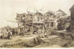
A police report in 1867 provides proof of the disorder in Bazaar. There is evidence that Macau was split up into two that made it look like dissimilar cities. The Chinese inhabitants thronged the bazaar on one side of the divide. The bazaar was characterized with slender pathways, deplorable sanitation and congested structures. On the other side of the divide was the Christian City. Both sides were not policed and there was partial dissemination of rights with no side willing to extend their advantages to another (Pinheiro et al 2005, 9)
The governor’s successors eventually implemented his guidelines that started with the knocking down of walls connecting Monte Forte and S. Jeromino bulwark. Eventually, at around 1878 and 1896, the doors were opened to cross-ethnic and cross-cultural integration as the city expanded and the Portuguese inhabitants proliferated S. Lazarus and villages in the direction of Mong Ha. The opposite was also witnessed as more Chinese people moved in to reside in the Christian City. The upgrading of the road network can also be accredited to Amaral’s policies which had entailed the road infrastructure as part of its blueprint. There was also the introduction of a lighting system that used oil (Pinheiro et al 2005, 10)
The process of retrieving land to be earmarked for the building of industries and houses was started. There was also a need to build an advanced port in order to spur the city’s commercial activity. The repossession of land was started out at the inner port in 1884. This exercise would later stretch on to recover land in the inner port en route to Barra Hills and drainage canals in the Baazar area. This was under the direction of Governor Count St. Januario. The temporary timber houses that dotted many places and were constructed over dirty mud were razed. This paved the way for the construction of better structures that guaranteed safety e.g. St Lazarus quarters, Volong, Tap Seac, etc. The pandemics that were grappled with earlier came to an end (Pinheiro et al 2005,10).
The operations of the port were not easy because of the incessant silting. There was a warning that the city of Macau would not be able to function without the port. It became imperative that the canal must be opened, Port and land developed for advancement in commercial activity. There was however resistance from the administration in China and Hong Kong. The two authorities had foreseen a threat to the success of Hong Kong and Guangdong. There was panic over a possible military incursion from The Pro autonomy administration that was driven by the conflict of extending the harbour closer to the mainland terrain. The only way out of the conflict was to establish a middle-ground-land in the sea. A concession was agreed upon to build a little of the inner port and a lot more of the outer port in Hac Sa Wan. It allowed for the development of piers and storm shelters, giving room for industry railway transport between Macau and Guangdong (Pinheiro et al 2005, 11). Some of the blueprints on ways to improve the inner harbour were later used to build ports after modification. With this expansion, there was a revival of the fishing port as it could now accommodate bigger vessels.

It has been established that the reason behind the feud between Amaral on one hand and his subjects was anchored off the description of a City. He pictured a modernized metropolis whereas the majority favoured the compacted Baazar in its unhygienic state. Normally the differences were ironed out using physical aggression. However incomplete policies were drafted to enable growth and a measure of solving the problems at hand. An outline was developed to define the structural design of the shophouses at the inner harbour area. A cape was constructed to link the Macau isthmus with the Green land (Pinheiro et al 2005, 11)
This section had no shop house ensued with a concealed pavement apart from the inner harbour and San Ma Lou Avenue. The coming of the Portuguese republic presented the most preferred alternative of developing a port and using the retrieved land in creating industries relative to using the repossessed land for farming a situation that was highly regarded by the monarchists. The progress of the Inner harbour and growth of the city was slowed down by the monarchists who readily gave in to the British authority. The control of the port of Macau was the only policy that could tackle all the challenges of the city especially those of Chinatown which had grown over during the time of natural development. The growth was also held back by the city walls that stretched in the direction of the rice paddies in the northern section of the cape that has been secured by the hilltops of Mong Ha and Fig 11: D. Maria II. Alterations in the populace affected Macau’s urbanization (Cheung 2000, 23).
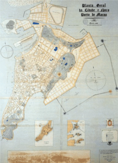
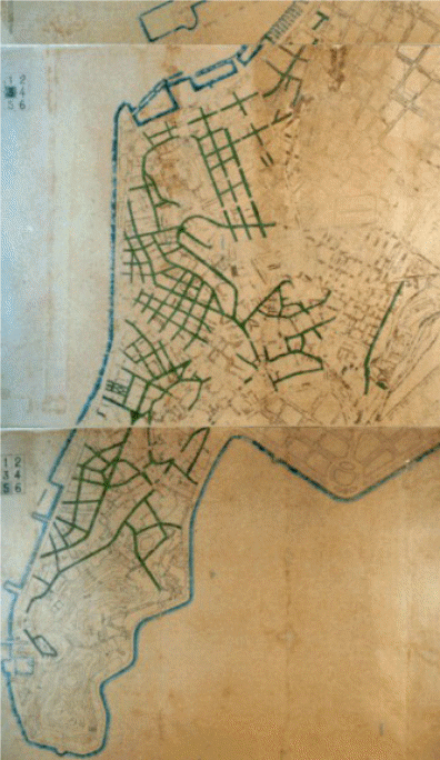
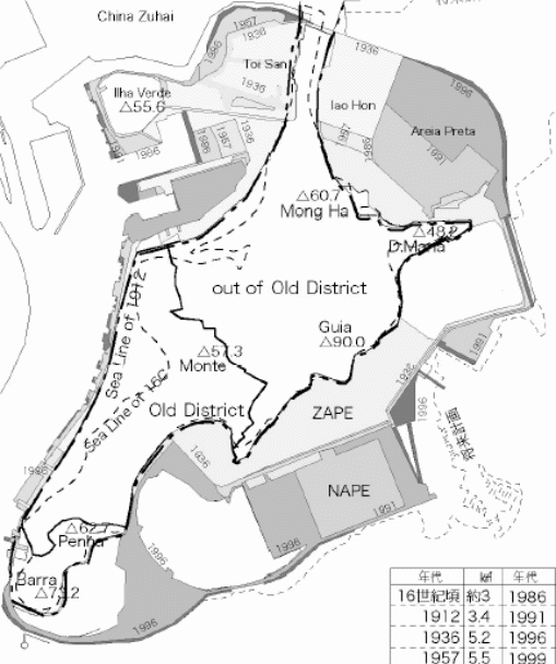
The Patane and Inner Harbour have the ability to hold or take in large numbers of people. A study of the population figures and its fluctuations is a reliable source of information that indicates this unique ability of accommodation as shown in the high number of buildings and expansion of land through recovery (Pinheiro et al 2005). Around 1889 the city expansion was condensed in the inner harbour region and away from the rice paddies that on the exterior of the old city walls. The cause of this pattern is explained by the fact that the Chinese bazaar had most of the commercial activities in the region started within its boundaries. It is hard to establish the period for which the structures at the harbour were built. The development of the shoreline can however be traced. It was as a result of profound depositing that spread to the rivers.


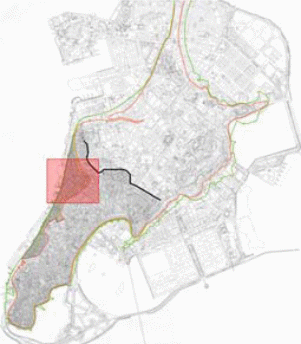
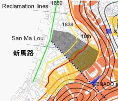
Large buildings called the Aflandega hosted the customs offices and storage and Armacoes housed shipyards and storage facilities. The large expanse of the Manducho shore has been consumed by the Armacoes. Map evidence shows that the traditional shophouses do not appear in the new regions that are on the exterior side of the walls. Nonetheless, they are seen in the Chinese city in industrial streets like Mercados and Rua Nova Del Rey. San Ma Lou Avenue is not indicated in the maps, the reason being that it was being developed at the time the map was created. Evidence has also been obtained from sources other than maps e.g. perspective views such as paintings. They have illustrated a slender line of buildings at the back of the churches, opposite the beaches at the inner harbour. From this evidence, it has been deduced that around the 18th century, the regions at the shores hosted the western shophouse typology and shipyards. The process of land recovery stirred up the extension of the Chinese city down the length of the beach. Land retrieval was stepped up in the 20th century but by the 19th century, most of this activity was done on the inner harbour. The significance of Chinatown reduced when expansive areas of the Northern and Western Cape were recovered (Pinheiro et al 2005, 14)
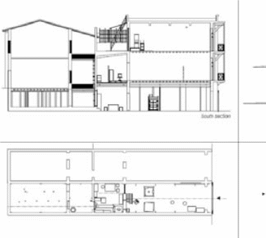
Macau’s Shop Houses
Its structural design is such that the key building is made of twin block walls which hold up the spherical wooden logs at the base and top. The purpose of the spherical log is to grip wooden floors and roof tiles in place. Twin walls form the roof gable and they stick out at about 30cm from the portico. The structural design of the roof is such that it extends above the street entrance establishing a shelter from extreme weather. This is an intelligent way of making the most of the twin walls. The typical measurements of the portico are established from the spherical four-meter wooden logs. Alterations are minimal but consist of small units which are put together. The extent of the gable walls ranges between 5 and 30 meters whilst in certain conditions they attain larger measurements.
There is an optional contracted entrance that lies amid the gable walls. The modern typology presented a structural design that had lots of its windows arched and adorned with stucco. The entrance is made of wood or granite rectangle. Inscribed in large fonts over the beam of the main entrance to rich households, is the family name of the kin. Many of its fortifications are constructed using “the blue brick” commonly referred to as Cheong Jun. In order to secure the lower portion of the portico from the muck that splatters on the walls during the rainy spell, a beam that stands at one meter in height made of stonework or additional tier of plaster is constructed. The key entry is characterized with additional layers of security which provides for a variety of forms that allows a variety of requirements. It could be a plain flat wooden model. At the height of the Qing’s reign the typology’s windows were made of tiers of translucent mother pearls enclosed in an uneven wooden edifice (Pinheiro et al 2005, 15). The French windows were very popular with this typology as it provided for more aeration and privacy as it covered the inside of the house from the inquisitive glare of neighbours.
Rationale
Asian cities such as Hong Kong and Macau are considered major international and financial centres. Hong Kong for example is known to be one of the most competitive economies in the world in recent years. This is promoted by the various development activities within the property sector including the sale of undeveloped land to property investors. Tourists’ activities despite being a major foreign exchange earner still account for a smaller percentage of the economy. This is due to over-reliance on the property sector, diversity can only be realised by investing in tourist products. In order to utilize the tourism industry, there is a need for governments to consider upgrading tourist attraction centres as well as improving the status of the available infrastructure. Creation of new heritage centres and development of pedestrian paths would contribute much to the increasing GDP of the various countries on an annual basis. Besides, there would be the creation of job opportunities either directly or indirectly and at the same time non-quantifiable benefits such as improved technology and quality living standards. This would enhance the international image of the cities, placing them as some of the key tourist destination centres owing to their vibrant nature.
Methodology
Sustainable development of heritage squares and city’s pedestrian road may present different aspects and measures depending on the various scale of concern. The study will cover various contexts based on time as well as space assumptions. The methodology section will explore the various research paradigms and design to be used in the research. There will be a necessity of developing research instrument and at the same time application of appropriate sampling technique will be necessary together with the identification of various limitations likely to be encountered within the field of study (The Government Logistics Department 2005).
The research study utilizes the use of qualitative and quantitative research methods focusing on non-tangible aspects such as perceptions and experience of the visitors as well as the local community. Combination of both positive, as well as interpretive views, is expected to contribute to the final outcome depending on the methodology applied. This would assist in maintaining the central objective of the research and at the same time eliminate any sense of bias data gathering methods. The research utilizes the use of random sampling which involves the non-systematic process of sample collection from the various cities. The method enables the incorporation of all the sections within the tourism industry. The approach makes it easier since it enables generalization of outcome results. In many occasions the sample size used is only used in creating conclusions based on the collected data, hence making the process indefinite (The Government Logistics Department 2005).
Study area
The research’s main focus is on environmental as well as economic perspectives of tourist city’s namely Macau and Hong Kong. Much emphasis would be placed on sustainable development in the context of tourism. The conceptual framework would be based on the destination life cycle model geared towards the development of the two aforementioned cities. The research considers tourist attractions as finite and timeless hence requires much attention in terms of protection and preservation.
Study period
The research focuses on the current situation within these cities, the kind of construction going on and includes insights concerning the future development of infrastructure and various attraction centres.
Sources of data
The research paper is majorly based on literature review. Secondary data would be obtained for study analysis. Butler’s literature on sustainable tourism as well as Environmental Impact Assessment Report on the two cities recorded within the last couple of years. Detailed discussion on the impacts of pedestrian roads and heritage centres on sustainable development within the tourism industry is presented. Despite all these, quantitative data concerning tourist activities from the tourism board of the two cities would be used for the analysis of the dynamicity of the industry. The study sample will be obtained from the various theme parks, restaurants and other tourist attraction sites within the cities. The study sample will include a few senior government officials from the development and planning department. All the participants would be required to verify their understanding of the subject being researched. All the participants will be protected against any intimidation from the higher authorities.
Research Tools
The data collected will be analyzed by the use of statistical charts, graphs, tables and maps. Implications from the analysis based on the two cities would then be discussed to reflect the necessity of developing pedestrian roads and heritage centres.
Tourism Statistics and Secondary Sources
The following results were mostly obtained from secondary sources of information and government statistics. The growth of potential visitors led to the attraction of potential investors to the tourist cities of Hong Kong and Macau.
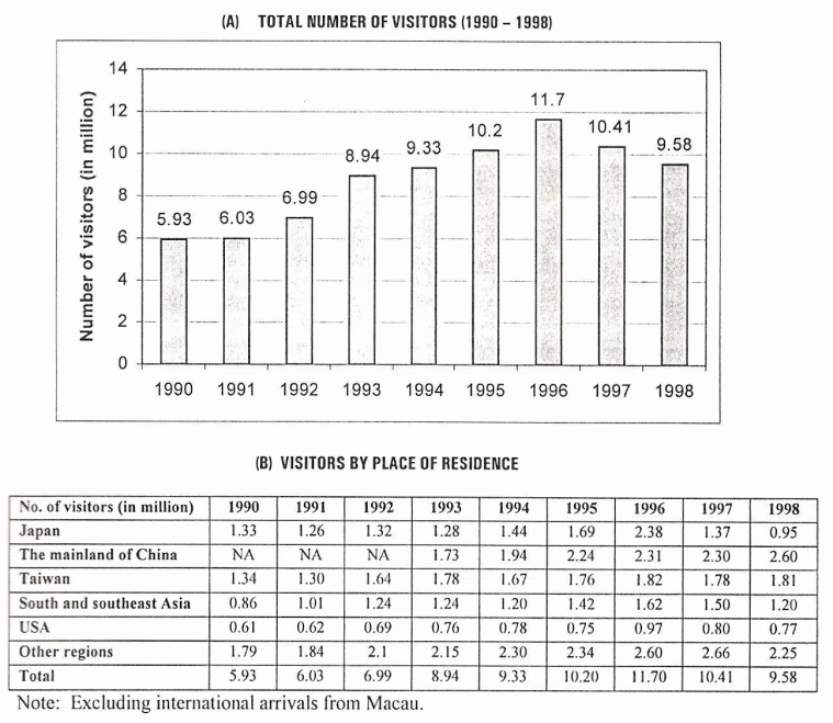
Table 1: showing Hong Kong’s Top five Markets visitor arrivals.
Table 2: Hong Kong’s Top markets based on overnight visitor spending (Tourism Board 2005).
The research processes involved covering consequent results on both inbound and outbound tourism. Inbound tourism targeted only visitors streaming in Hong Kong and Macau cities while outbound tourism which mostly covers travel and airline ticket agents and those passengers crossing borders especially of Hong Kong origin travelling overseas.
Environmental Dimension; Impacts of construction works
There are several sites suitable for the development of heritage centres such as Disneyland. The sites were discovered within the North Lantau and Shatin. Project settings department, as well as Civil Engineering Department, assisted in the construction decisions including the essential associated infrastructures for roads and theme parks.
The construction works would involve the construction of 4 km rail line with 850m tunnel as well as stations within Penny’s Bay and Yam O, which provides a link between Tung Chung Line and the nearest theme park. There would also be the construction of infrastructure used for general works such as storm-water drainage system, sewerage system, water supply alongside utility services. The other important work would involve stabilizing the sloppy ground alongside landscaping works. The figure below shows some reclamation works being undertaken at Penny’s Bay Hong Kong in the year 2001.
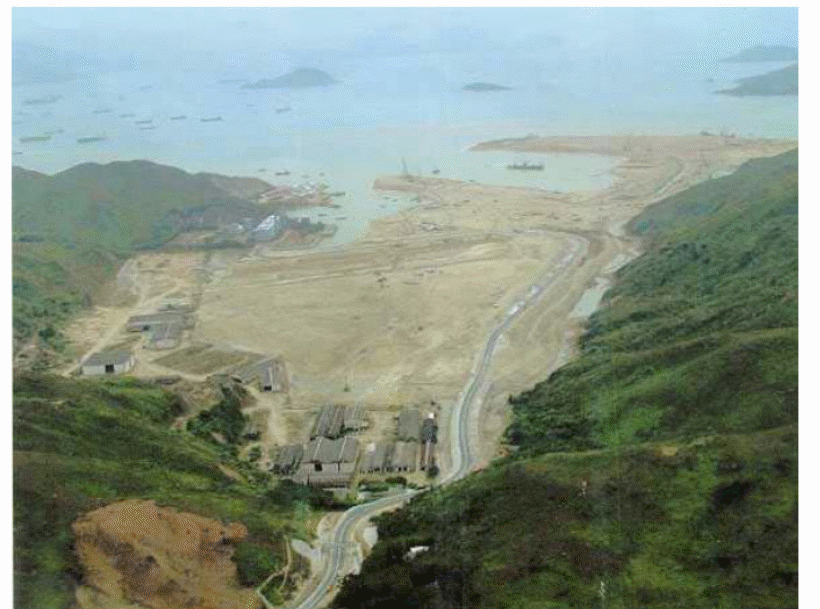
Key environmental impacts arising from the construction activities and project construction includes several processes with various effects. The impact on the Air quality could be related to the effects of dust nuisance alongside gaseous emissions from the construction machinery. The various activities include site formation, construction of various facilities such as hotels, water recreation Centre, roads, and railway including pedestrian footpaths. Air emissions from fuel combustion from the machinery used, odour emissions from sewage stations and also fireworks displays are all the concern of the various developments (The Government Logistics Department 2005).
Noise also has a very big impact on the environment, powered mechanical equipment used in the construction process presents the primary source of noise to the immediate environment. Some of the major activities involve the reclamation of the site and the construction of the surrounding sea walls, construction of access roads as well as pedestrian paths, construction of railway link, sports recreation centre, and the construction of other facilities. Another potential impact is on the quality of water caused by the formation of reclamations, other land-based works such as the construction of roads and theme parks. Further assessment anticipated presence of an exceeding Water Quality Objectives caused by suspended sediment caused due to accumulation of all residues from construction sites. However, all these cumulative impacts could be managed through preventive measures which include the use of advanced technological construction methods. Increase in the level of concentration of suspended sediments was discovered to have less adverse effects on the cultured fish hence not much negative impact (The Government Logistics Department 2005).
The other impact concerns waste management. Majority of the waste originates from the construction sites which includes; dredged materials, fragments from demolished sites, spilt chemicals amongst others. Reclamation of the Penny Bay would accommodate over 1.8 million cubic metres of landfill. All the reclamation activities done on the constructed bays would utilize sandfill. This would be an increase in the amount of municipal solid waste owing to the nature of massive construction activities involved, this was estimated to be approximately thirty-eight tons per day (tpd) within the last five years but expected to triple fifteen years from now. However, out of the massive waste, a good percentage is expected to be recycled through local means. This is since there is the major market for the existing recyclables. Planning and development sector should encourage programs enhancing recovery of recyclable wastes from the stream of both compostable and non-compostable refuse. Waste management department should adopt targets for various recovery plans which would assist in the determination of practical recycling rate (The Government Logistics Department 2005).
Land Contamination
“The construction of the various facilities and infrastructure was based on the relevant authorization by EIA. To allow associated developments EIA Study has to be a stand alone’ assessment, the relevant land contamination section of the NLDFS EIA was included within this EIA, the assessment is not fully based on the study brief within the research. For the purposes of providing the necessary quantitative information, some sampling was conducted across the construction sites. The results obtained from the samples collected indicated considerable concentrations of hydrocarbons as well as metallic components. Almost all of the detected metal compounds were noted to be below the respective Dutch” Value concentrations, which would imply clean, uncontaminated soil”.
“As appropriate remediation will be performed for the CLS site before construction of the infrastructures such as road and rail elements, future potential negative land contamination impacts are judged to be minimal. Remediation works will be required to meet the EPD standards. The NLDFS assessment will be verified by CED in a separate EIAO Schedule 2 EIA for the CLS site. Thus, it is considered that there will be no potential residual negative impacts and no insurmountable constraints associated with the future use of the tourist sites”.
Territory-Wide Environmental Implications
“The territory-wide environmental implications of the additional visitors to the Theme Park were addressed in broad terms. The air quality assessment concluded that the territory-wide air quality impact due to infrastructure construction and related traffic is not significant. Operational water quality modeling predicted that there would be no breaches of the Water Quality Objectives due to the treated sewage effluent and stormwater discharges from the Theme Park and therefore concluded that there would be no associated adverse territorywide or local impacts to water quality. The quantity of solid waste arising from the infrastructure construction operation can be handled by the North Lantau Transfer Station up to 2016. This evaluation assumes that no waste reduction measures are in place; however, HKITP will introduce source separation schemes to reduce the quantity of waste to be disposed”.
Environmental Monitoring and Audit (Em&A)
“As summarised above, and detailed in the Project EM&A Manual, the EIA Study has recommended a comprehensive EM&A programme comprising monitoring before construction and monitoring and audit during both construction and operation of the Project for: air quality (baseline, construction and operation), noise (baseline, construction and operation), water quality (baseline and construction), waste management (construction and operation), terrestrial ecology (baseline, construction and operation), and marine ecology (baseline, construction and operation)”.
“Overall, the EIA Final Report for the Theme Park and associated developments has predicted that the Project will comply with all environmental standards and legislation after the proposed construction and operational stage mitigation measures are implemented. The EIA has thus demonstrated the acceptability of any residual impacts from the Project and the protection of the population and environmentally sensitive resources. Environmental monitoring and audit mechanisms have been recommended before and during construction and during operation to verify the accuracy of the EIA predictions and the effectiveness of recommended mitigation measures”.
Natural Appearance of Hong Kong
Hong Kong landscape portrays very beautiful sloppy terrain bordering vast coastline hence making the place a good site for the natural harbour. Such physical context normally has various significant implications on the nature of the urban within the area. The physical characteristics have given Hong Kong a superior elevation bordering both sides of Victoria Harbour and also is considered to be against a dramatic mountain backdrop. The surrounding steep topography has promoted the existence of other urbanization within the various parts of Hong Kong leading to flat and reclaimed land with the mountain ranges providing the necessary natural landscape required for the development of urban settlements. At the same time, the mountain ranges provide the city with unique view sheds. The viewsheds develop in different density which gives some room for the existence of visual environment within the closest view sheds.
Hong Kong Island
The Island has got a unique natural setting reinforced by the existence of Victoria Peak. The developments within the areas in the north shore should consider the existence of Victoria Peak as well as other peaks existing around the city. This should incorporate the regions surrounding the cultural district of Kowloon which comprises of several minor cultural centres such as Tsim Sha Tsui and other heritage centres found in the South East region. Planners of the city development should consider the height of buildings which at some point might interfere with the free viewing zones utilized by tourists. The extended fascinating view of the mountains, sky as well as sea, creates some magnificent image sweet for viewing. Protection maintained on the views towards Victoria Peak as well as the ridgelines from the coastline gives the important retention of the city’s heritage (Kaye et al 2002).
The process of development should consider some city aspects such as the nature of buildings appropriate for different locations since this would help in maintaining the heritage of some specific areas including neighbouring cities. The nature of the landscape should be used in the duty of establishing appropriate building heights. Any developmental activity should strictly consider the various sections of the city in order to maintain height diversity. Government Department concerned with development should ensure that low rise accommodates appropriate buildings as well as low-density areas since this would enhance diversity within the commercial area.
Guidelines for New Towns
Equitable planning for urban development mostly follows the nature of environmental improvement. This starts from development of every part of the city to an international level based on sanitation, improved water services, good housing as well as sufficient living space. However, the creation of high standard cities normally requires much effort in terms of resources. This includes protecting populations from environmental hazards, ensuring the availability of adequate and affordable social services, conservation of available clean energy deposits for the purposes of reducing cities’ environmental footprint and impact. Their crucial achievement realised when practising integrated spatial development as well as committing the development towards achieving social equity in the process of planning are very instrumental in creating harmonious cities.
The Socio-cultural Dimension
The city of Hong Kong presents a rich environment consisting of various cultural representations. The design of the city is based on careful planning as well as rational management style. Public areas are maintained in a clean and seemingly orderly manner with the design mechanism of paths, restaurants and bridges proving to be efficient. This is since the productivity levels and control of the crowds are easily coordinated. Theme parks are used for the purposes of regulating the movement of tourists in specified and prescribed ways. This makes it easier for the management to control public behaviours including social mixing hence making tourists experience comfort within the target areas. Through such experiences the visitors are made to keep spending and moving with a lot of ease, especially in the theme parks which are designed to make visitors consumers, hence generating lots of income.
However, the approaches used in urban planning and development have greatly changed with time. Local governments are currently responsible for the planning and development of cities while at the same time involving their citizens directly in the planning processes. The rapid growth of the urban centres within developing countries has bees associated with various challenges such as traffic congestion, pollution, and overcrowding and high crime rates. Such conditions can be avoided through the application of good governance and visionary planning. Urban planning despite being a technical issue also incorporates a lot of political dimensions. 5.6 Economic Dimension
Hong Kong is known as a major trading centre in Asia and at the same time one of the top-most competitive economy in the world. The government seem slow in adopting development plans in the tourism sector such as the building of heritage centres. This was realised after the economic recession of 1997. However, the government accepted to enter a deal with Disney which was anticipated to the capability of turning around the slow economic growth of the country. The construction led to an increase in the number of attraction centres hence more tourists experienced annually. Amongst the tourists will be family travellers from the region in addition to the business travellers and those tourists travelling for the sake of shopping.
The San Ma Lou Avenue
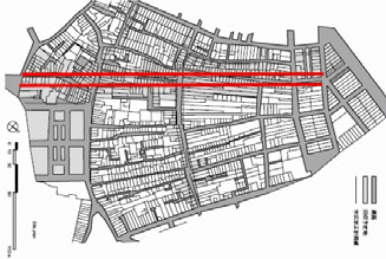
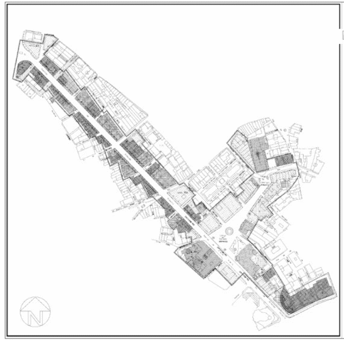
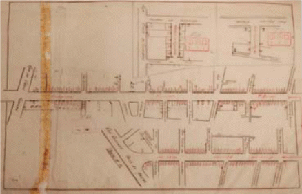
A new shophouse typology is initiated in an event to commemorate the launch of an additional street in Bazaar, now known as the San Ma Lou. The street was launched in phases i.e. the approval phase demolition phase and construction phase. The demolition phase extended to the inner harbour whereas the construction phase connected the Senate square with Praya Grande. The activity was beneficial to the hygienic conditions, organization and economic advancement. The initiative was seeking to involve the segregated quarters in Chinatown that came about by the bazaar shophouses and the carpenters’ shophouses at the riverside. In an ironical twist of events, the launch of San Ma Lou brought good commercial returns to the outer harbour and a dip in the commercial gains of the inner harbour. The inner harbour economic prospects were also dented by the opening of jetfoil depot and deep water harbour in Coloane (Pinheiro et al 2005, 18)
Four causes are analyzed as possible effects to the decline of Salou Concentrated traffic and pollution as well as preferential development of the outer harbour at the expense of the inner harbour. Too little was done to repair the shophouses after their porticos were reclaimed. The government constrained restitution and limited discussion with the shophouse community (ChengKang 1996).
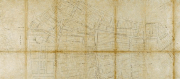
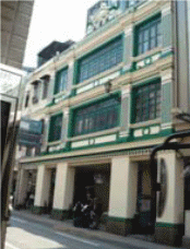
The structural design of the front side of the shophouses in San Ma Lou differed from the common ones in Chinese City. It introduced new techniques of art that are comparable to the shophouse typology of Singapore. The structure has a unique feature to it that offers shelter from extreme weather.

A policy was developed to offer security to this region. The policy established a holding area to which the construction of elevated buildings was regulated. However, this was not adequate to rescue the structures from their deterioration. Preservation and a feasible fiscal strategy are essential for longevity.
The San Ma Lou shop houses possess the same outlook. Absent in their structural design is the corridor and courtyards that are found in the Singaporean and Malaysian typologies. There seems to be a similarity in construction in terms of their expanse and ventilation. The shophouses San Ma Lou, Hong Kong and Macao share these features. In 1992 a verdict (83/92/M) was imposed. The recording of all types of historical collections was centred on a formula of assortment devised by the Cultural Institute (IC) of Macao. It accommodated the San Ma Lou structures as part of its historical collection. Most of Macau’s memorabilia and important locations were enshrined in the application forwarded to UNESCO to categorize Macao as an element of the global inheritance. The reclamation of the Pawnshop towers which was a widespread mark of Chinatown was of great achievement. San Ma Lou which was a fresh economic avenue adopted two of the pawnshop towers. The refurbishment of the Tak Seng On structure was recognized with a mention award from UNESCO. More structures in San Ma Lou could be urged to pursue the same route in establishing pawnshops (Ismail et al 2005).
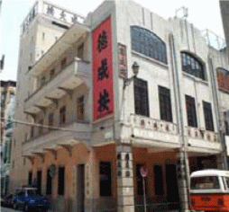
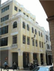
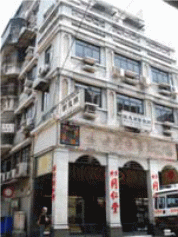
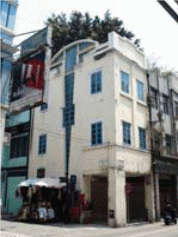
Tak Seng On pawnshop was at one time planned for habitation, however the owing to the decrees that covered it, the front side was to be left untouched while being demolished. Some of the buildings escaped demolitions like the Dak Seng on Tower whose arranged alteration to housing was never solidified. A visit by the cultural institute established that the condition of this structure was still superb. They also discovered precious ancient documents and furniture covered in dust. The Cultural Institute and the proprietor made a settlement to jointly convert the structure into a museum and shop. The pawnshop and tower would later be reinstated in the building by the IC. Part of the structure was turned into a cultural club. The club offered ancient tea practices complemented with a collection of literature by Jin Young. It also housed a souvenir shop (Carita 2003).
Transition region between urban and rural areas
Urban fringe is the section of land separating the urban developed and the developing rural regions surrounding the city. The fringe areas are strictly protected since it creates an appropriate natural environment providing a transition between urban and rural environment. The nature of the linkage determines the level of quality of life lived within these areas. Planning should consider rural areas where the building height as well as massing form is harmonised with the existing nature of the rural set-up (Terri 2004, 10-44).
The predominant urban forms found in tourist destination areas such as Hong Kong are characterized by high-quality developments built away from narrow streets. In Hong Kong, the ridgelines present at Victoria Peak and Lion Rock presents unique physical features for along time (Yagi 2005). The story is different since currently the features are obscured by increased growth of high-rise buildings. Preservation of the ridgelines in the process of development could be of great benefit since they are considered valuable assets. Height profile should be aimed at enhancing the relationship between the city and natural landscape, hence building free zone under the ridgelines would be necessary for viewing from key points (Terri 2004, 10-44).
Kowloon side presents continuous stretch of peaks starting from Lion Rock to Kowloon Peak. The nature of the peak presents an interesting scene from the East and South-East sides. The building free zone should be considered by the development heights found within view corridors. The setting of the city should be capable of accommodating major developments within the central area and the low rise developments towards the outcast of the town. All the breezeways require maintenance as well as landmarks within the commercial centres. Location of mega towers should also be considered based on physical and functional characteristics. In Hong Kong, the areas considered to rise as new major-rise are the West Kowloon Reclamation and Tsim Sha Tsui regions (Terri 2004, 10-44).
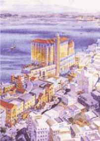
Upgrade of the Victoria Harbour would enable easy access hence bringing the harbour close to the people and vice-versa. The same would ensure clear visual access towards the harbour-front. Innovative building designs would encourage the integrated road network opening space for pedestrian links. Sustainable development should be maintained within the city since it serves as both government and public property. The principle of the presumption against reclamation is used for sustainability purposes ensuring quality environmental standards and at the same time partitioning the sites along the coastline in accordance with appropriate activities which flows with the region selected (Terri 2004, 10-44).
Major activities providing excitement and visual interest would be developed within the active waterfront. Some activities have proved to be detrimental to the lucrative tourism industry along the coastline. These include cargo handling as well as the construction of major roads across the beach land. The waterfront should be utilized for such activities as cycling, fishing, strolling amongst other activities. The area should as well be utilized for landscaping, boardwalks, small piers and sitting out areas. The design of the waterfront should consider upgrading its form based on the waterfront setting. The various building heights and spaces should consider human movements, where there is room for easy usage as well as interactions (Terri 2004, 10-44).
The presence of limited land in Hong Kong provides some difficulties with respect to human scale. This could be improved by creating more room for transitional space, landscaping as well as a streetscape. Human dimensions have been utilized as the primary yardstick for removing unnecessary tension in the planning and development processes. Despite this, the harbour should be marked by diversified building masses for the purposes of avoiding monotony in the expected harbour image. Coastal sites should be dominated by low density and low rise development. Pedestrian footpaths should be enhanced through expansion to enable accommodation of large numbers without experiencing any form of strain. Vehicles and other y should be parked away from the waterfront. However, open space should be created on the landward side to serve as an entry point; the open space deserves to be organized in different patterns to accommodate various functions such as social and cultural events.
Study on Neighbourhood Mainland China
China is known as the world’s emerging superpower and also for its liberalization of trade. The development planning of buildings within their cities seems welcoming to more business travellers and tourists. The development of conventions and exhibitions centres within China has taken place at a very high rate. For example, Shanghai city in China has developed new facilities used for conventions as well as exhibitions. Shanghai and other Chinese cities competed with Hong Kong for leisure tourism owing to the availability of historical monuments as well as natural sceneries. In tourism attraction, the mainland Chinese cities have been found to provide cheap land for construction making it have an advantage over Hong Kong and Macau since this has promoted the construction of expansive exhibition venues. However, there is a need for building massive infrastructure in China for the reasons for accommodating the frequent influx of domestic tourists as well as visitors from other backgrounds (Son 2010, 1-11).
Strengths and weaknesses
The tourism sector in Hong Kong majorly relies on private developers. Several firms as well as service industries have emerged in support of hotels and travel agents. The various firms operate from the airport and educational facilities and provide employment and training to the population having low skilled labour. The weaknesses of Macau city is the overload experienced in the infrastructure. The capacity of their institutions to train and develop a workforce for the tourism sector is low hence unable to match the increased demand for skilled labour. The city’s enormous need for labour owing to its labour-intensive sector provides a threat to neighbouring tourist attraction cities such as Hong Kong.
In comparison to Guangzhou, the accessibility to tourist facilities on both Hong Kong and Makau cities seem challenging especially to people with disabilities. The current situation of tourist facilities in Guangzhou City seems relatively substandard compared to that of other cities hence providing a potential barrier to visitors with disabilities. There are several problems concerning accessibility in the process of serving visitors with disabilities. This calls for the development of barrier-free tourism through the improvement of facilities and services. The access issues on tourist sites, barriers encountered by most visitors with physical disabilities as well as the nature of travel facilities within these cities require attention. Extensive research was done on Guangzhou city to provide a detailed report on accessibility to tourist sites for pedestrians and people with disabilities and ultimately provide guidelines on the enhancement of travel experiences (Son 2010, 1-11).
The national standards on the construction of buildings in China from 1990 provided that all new buildings be constructed to allow access to people of all walks of life. The Act providing for the codes for the Accessibility of People with Disabilities was passed and enforced in the year 2001. This included the reconstruction of urban roads and buildings. This improved the level of access to public and tourist attraction sites hence promoted barrier-free tourism. The passageways, as well as restrooms within public places, have accessible rooms for all and this applies also in hotels, as well as other accommodation buildings. City legislation in China contrary to that in Hong Kong directs that all buildings and public areas should provide accessible facilities such as ramps, facilities for people with sight problems i.e. tactile paving tiles, parking spaces as well as lifts (Son 2010, 1-11).
The environment within Beijing has so much changed for the disabling ranging from public transportation tourist facilities since 2008. All the subways within the city are considered more disabled-friendly. The infrastructural improvement could be realized within the pathways leading to the Palace Museum, the Forbidden City as well as the Great wall enabling easy access. Most of the recreation areas within Hong Kong and Macau city are not well equipped to accommodate those on wheelchairs making leisure experiences horrible to those with disabilities (Son 2010, 1-11).
The current issues on construction of streets, roads, heritage square and buildings in developed cities such as Guangzhou for the purposes of providing accessibility to tourist sites provided the basics of this research. Several tourist attraction centres were visited and analyzed; ten were selected in this study; three historical sites, three museums, two pedestrian shopping streets and two shopping malls. In this study, the movements of various people were studied including those with disabilities. Out of all the movements, the accessibility to various sections was checked, that is, accessibility from subway stations to main entrances, internal accessibility of various buildings and heritage squares, facilities used to serve accessibility purposes such as ramps, lifts and signage (Son 2010, 1-11).
Evaluating Tourist Accessibility
Results obtained concerning accessibility on visiting sites within the city revealed that tourists’ attraction points deserve accessibility of the highest order to provide visitors with full participation in tourist activities. The presence of accessible pathways within the bus stop, pedestrian streets and heritage centres should be of greater concern. The research revealed that the condition of streets and roads within Guangzhou was not that comfortable to allow movement of the disabled tourists. The problem could be attributed to the poor design of infrastructure as well as lack of established signs. Such design problems posed considerable difficulties to tourists accessing the various attraction sites. One good example emerged in visiting one of the pedestrian shopping streets, from the subway there were no continuous rumps linking different street levels leading towards visiting sites.
The available ramps seemed too steep for the disabled, hence hindered their movements upwards. The streets were jammed with tactile paths, signposts, parked cars and bicycles which hinder the movement of pedestrians such as those using wheelchairs as well as other kinds of visitors. The signposts placed on the roads and streets seemed not clear and helpful to the section of tourists especially the disabled. However, Guangzhou city installed tourist route maps enabling easy navigation. The route maps and signposts sideline the disabled tourists, making it difficult for them to get to their destinations in time (Son 2010, 1-11).
The main entrance to buildings as well as access to other sections of heritage centres provides difficulties to the independent movement of disabled tourists. In most instances, stairways are used within the building which poses a great obstacle to the physically disabled. The situations of construction within the tourist attractions seem poorly planned. The nature of constructed rumps within the shopping malls within the city seems helpful. However, the entrances of tourist attraction canters appear not fully accessible owing to the presence of many staircases. This could be identified in the entrance of the Guangzhou Museum where those using wheelchairs found it difficult to access the facility. However, two facilities within the city provided other special entrances to the physically disabled tourists; these are Sun Yat-Sen Memorial and Nan Yue King’s Tomb Museum. Construction of ramps beside the buildings and attraction centres with clear signposts could solve the accessibility problem especially to those with disabilities. Picture 1 below provides one of the stop shops within the streets having steps without providing for those on wheelchairs. Some places provided a steep ramp for accessibility purposes as shown in the subsequent picture. However, the level of ramps should be well adjusted and steps removed (Son 2010, 1-11).

The tourists’ attractions had the problem of accessing other floors. However, the movements are made easier by the use of elevators which enables the independent movement of the disabled. The other sites such as museums, heritage and historical canters did not provide facilities enabling easy access to other upper floors, hence limiting the nature of visits by tourists (Son 2010, 1-11).
Mobility issues within this city seem difficult, especially when it comes to accessing public facilities such as toilets. The tourist attraction sites covered in this research did not provide adequate facilities capable of serving tourists from all walks of life including the disabled. The public toilets were completely inaccessible to those with wheelchairs. However, the sites that provided for these facilities seem poorly managed and designed. Some of the toilets had insufficient space not allowing free turning, hence inconvenient to tourists on wheelchairs (Son 2010, 1-11).
Discussions
The whole study focused on issues dealing with accessibility especially the physically challenged within Guangzhou. The assessment more so focused on those operating on a wheelchair, i.e. those with a physical disability. According to the study, the current situation within the tourism cities requires attention. The kind of facilities provided does not provide for the disabled tourist market. Most of the sites were marked with a lack of supporting facilities including lifts, ramps as well as adequate information on the use of some facilities. This created difficulties in accessing various tourist attraction sites as well as pedestrian streets, hence denying participation in some crucial tourist activities. The findings within this study resulted in a number of recommendations having the potential of improving the conditions experienced within Guangzhou tourism (Son 2010, 1-11).
Comparison with Macau’s Shop Houses
As discussed above the structural design of Macau shops are such that the key building is made stronger walls which sustain the spherical wooden logs firmly on both ends. The spherical log as explained holds firmly the wooden floor which makes it easier the construction of ramps whenever necessary. The structural designs of the buildings are such that the roof extends above the street entrance establishing a shelter hence providing safety to the disabled visitors. This provides an added advantage on Macau pedestrian streets making it preferable compared to Guangzhou. The construction materials utilized are made wooden logs of preferred length. The shops are constructed in such a manner that alterations are reduced but consist of small units which are put together.
The entrances, in this case, are improvised such that the gable walls are reasonably constructed whilst in certain conditions, they attain larger measurements. This makes it easier for the construction of optional entrances for the benefit of the disabled. “The entrance is made of wood or granite rectangle. Inscribed in large fonts over the beam of the main entrance to rich households, is the family name of the kin. Many of its fortifications are constructed using “the blue brick” commonly referred to as Cheong Jun. In order to secure the lower portion of the portico from the muck that splatters on the walls during the rainy spell, a beam that stands at one meter in height made of stonework or additional tier of plaster is constructed. The key entry is characterized with additional layers of security which provides for a variety of forms that allows a variety of requirements. It could be a plain flat wooden model. At the height of the Qing’s reign the typology’s windows were made of tiers of translucent mother pearls enclosed in an uneven wooden edifice”
Also, there is a presence of Chinese City within Macao Inner Harbor which was urbanized at the same time as Christian City. The City was known to offer direct benefits to the outer port. Chinese City accommodates Chinese migrants who through toil developed homes around the various beaches. The nature of construction adopted in the building of the street houses encouraged tourists from all walks of life, this is since there is the provision of design from both cities of Macau and Guangzhou. However, it is considered that the unique construction started in Macau before spreading to the Chinese mainland. Asian type of construction was majorly adopted within several port cities and before gaining entrance into china mainland cities.
The Asian shophouses were finally embraced to form part of the great economy within the region. “The shophouses were modified in 1822 by Sir Stamford Raffles when he changed the structural design from a more open layout to a closed one. This design offered a shade on the pavement that would shelter the population from extreme weather. He developed a means to enable the masses to gain entry into the interior areas of the structure that not only hosted business premises but also homes. The British would later adopt new guidelines for construction that approved of tougher materials as a precautionary measure against fires. The new structures would now be constructed using blocks and would be crowded together to ensure durability. Different backgrounds merged together in the city of Macao to create an advanced fusion impacted additional metropolis”.
Limitations
There was time constraint in the period of the research making it impossible to obtain primary data. Hence, most of the data used in this research are secondary data from published texts, internet and government statistics. This makes the data not that up-to-date and at the same time might not be comprehensive to the quality standards. Most of the report was obtained from the Environment Impact Assessment (EIA) report. At the same time, the period of the study might not allow a thorough evaluation of the various impacts on sustainable development within the tourism industry. Conceptual ideas and statistical estimations were majorly used due to lack of empirical data which could be used for full analysis.
Conclusion
The nature of construction activities would to an extent affect the environment, economy and culture of the natives. Construction projects should comply with all the set environmental standards and the various laws safeguarding the people’s rights. The quality of the environment and sustainability proves vulnerable hence care should be taken to prevent slight changes which might trigger great and permanent damages to the environment. The Asian cities will face many challenges in the process of trying to minimize the level of harm on the environment and at the same time trying to cope with the influx of tourists expected in the near future. To be regarded as a world-class tourist destination, the specified regions should give priority to environmental improvement.
All stakeholders within the tourism industry should cooperate in ensuring the development of sustainable forms of tourism. There is a need for partnership between public and private sectors especially in planning and making viable strategies capable of producing results in the long-run. The same level of cooperation and partnership is required between the local tourism industry and foreign tourism-based organizations ensuring the continuous provision of clients as well as the required services. There is also a need for reinforced partnership between the community and the visitors ensuring harmonized understanding and co-existence. The governments should consider striking a balance between economic returns and environmental conservation for the purposes of achieving sustainable development. All practices need to be environment friendly and consider various social responsibilities. There needs to be a complete reduction in the level of waste both in form of human and natural resources with the focus on tourists and the local community.
The origin of the Asian shophouses is not in Macau. Most of the shophouses were established in Chinatown and its advancements were rapid up until the population migrated to improved areas. The new San Ma Lou Street developed in it a modern typology of the shophouse. Its introduction interfered with the customary practices of Chinatown. It opened up the barriers with the Christian city and with it came a brief time of flourishing. The San Ma Lou was characterized by the successful refurbishing of Tak Seng On (Prescott 1993). This achievement was rewarded by the UNESCO. It also demonstrated the benefit accrued by reclaiming historical structures in the region and conserving then for customary and economic purposes.
UNESCO put Macao’s heritage hub on the global front by enlisting it into the many world heritage centres. This development spurred the number of visitors to the place and influenced rapid urban advancement owing to tourism. It has been recommended that this street be converted to use by pedestrians. This initiative is beneficial to the reclamation and conservation of the shophouses that will in the long-run profit both the inhabitants and the tourists.
Several environmental issues could always be addressed through observation of the economic status of the targeted tourist city. This could be realised based on the population trends and nature of carrying capacity. Such data would easily reveal the level of exhaustion of natural resources as well as human capital. The concepts used in defining sustainable development and economic growth should be connected with the objective, providing enough protection to the available resources as well as providing the necessary satisfaction to the population. The kind of construction work taking place as well as the level of emissions could pose dangerous effects on the climate. The level of productivity and consumption could at times result in the increased rate of environmental degradation. However, the increase in such rates in most cases symbolizes economic growth.
Rapid growth in environmental problems all over the world could be attributed to a rapid increase in population which ultimately strains the carrying capacity of given areas. This has contributed to the poor provision of services and resources within the specified places. There exist several domains which contribute towards environmental degradation and these include cases such as; industrial pollution, deforestation, land excavation and urbanization. Environmental pollution has been the result of extreme exploitation of the natural resources creating irreversible situations hence making pollution one of the biggest threats towards social livelihood. Records from the World Health Organization, reveals that approximately two million people die every year out of air pollution the number being exclusive of those suffering ailments and diseases which could be traced from the same sources.
Reference List
Butler, William. “The concept of a tourist-area cycle of evolution and Implications for management.” The Canadian Geographer, 24 (1980): 5-12.
Carita, Helder. The Dock Warehouse in Cochim, India. Revista Oriente. Abrol: Lisboa, 2003.
ChengKang, Fei. Macao 400 years. Shanghai: The Publishing House of the Shanghai Academy of Social Sciences, 1996.
Cheung, Ferdinand. “Tenement Buildings: In Light of their Origin.” HKIA journal, 24 (2000).
Conim, Custodio and Maria Teixeira. Macau e a sua populacao 1500-2000.
Aspectos demograficos, sociais e economicos. Macao: Macao’s Department of Statistic and Census, 1998.
Fernades, Jose Manuel. In the Heritage of Macao – II, Architecture and Colonialism. Review of Culture n 38-39, 2nd series, International edition. Cultural Institute of Macao, 2001.
Ismail, Wan and Shuhana Shamsuddin. The Old Shop houses as Part of Malaysian Urban Heritage: The Current Dilemma. 8th International Conference of the Asian Planning Schools Association, 2005.
Jeffrey, Cody. Cutting Fabric, Macau’s San Ma Lo (1910-1922) Dialogue Magazine. Special monograph issue on Macau. Taipei: Mei Jaw Publishing Co. Ltd, 1999.
Kaye, Chon, Vincent CS Heung, Kevin KF Wong. Tourism in Asia: Development, marketing & sustainability: the Fifth Biennial Conference.
23-25, 2002, Miramar Hotel, Hong Kong SAR: conference proceedings. Hong.
Kong: School of Hotel and Tourism Management, Hong Kong Polytechnic University, 2002.
Mathieson & Wall. Tourism; Economic, Physical and Social Impacts. New York: Longman, 1982.
Ng, Edward. “Regulate for Light, Air and Healthy Living.” HKIA journal, 37 (2004).
Pinheiro, Francisco, Koji Yagi, and Miki Korenaga. “Role of the Iberian Institutions in the Evolution of Macao.” Journal of Asian Architecture and Building Engineering, 2 (2005).
Plog, Stanley. “Why destination areas rise and fall in popularity.” Cornell Hotel And Restaurant Administration Quarterly, 14 (1974): 55-58.
Prescott, John. Macaensis Momentum. Hong Kong Institute of Architects, the Architects Association of Macau and P+P/DG Macau, 1993
Prosser, George. Tourist destination life cycles; progress, problems and Prospects, paper presented at National Tourism Research Conference. Australia: Melbourne, 1995.
Scott, Wilson (Hong Kong) Ltd. in association with Environmental Resources Management, Shankland Cox, Wilbur Smith Associates. Environmental impact assessment: construction of an international theme park in Penny’s Bay of North Lantau and its essential associated infrastructure. Hong Kong: Environmental Resources Management, 2000.
Son, Aram. Developing a Barrier-Free Tourism: Making a City of Guangzhou a better Tourism Destination for All. Guangzhou China: Sun Yat-Sen University, 2010.
Susan, Horner and John Swarbrooke. International cases in tourism Management. Oxford, Burlington, MA: Elsevier Butterworth-Heinemann, 2004.
Terri, Mottershead. Sustainable development in Hong Kong. Hong Kong: Hong Kong University Press, 2004.
“The Government Logistics Department.” Hong Kong Disneyland – Background Information. Hong Kong, 2005.
Yagi, Yuzaburo. Master Thesis Study on the Macao Chinatown in the Inner Harbour. Tokyo, Hosei University, 2005.