- The Establishment of Canberra as the National Capital
- The architectural aspect of Canberra
- Transport in Paris – Velo Liberté
- Bogota – building a sustainable city
- Greatest cities of the world with Griff Rhys Jones – London
- Transport and Portland – a sense of place
- Transport in Seoul – stream of consciousness
- References
The Establishment of Canberra as the National Capital
Overview
The journey towards the establishment of the capital city of Australia was long. This is because there were disputes during the choosing of the perfect site for the capital city (Fitzgerald, 1987). During that time, Melbourne was the largest city in Australia. It appeared like the perfect place to establish the capital. However, the western colonies, which included Victoria, South Australia and Western Australia, thought otherwise. They supported Melbourne as a suitable location. Sydney was supported by two colonies. This is because it was older than Melbourne and it was the only other large city (Gillespie, 1991). Finally, Melbourne was selected to be the capital temporarily as a new one was built elsewhere. After an extensive search, Canberra was chosen.
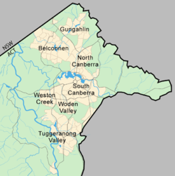
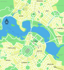
To select a proper layout for the capital city, an international competition among architects was held. Walter Burley Griffin won. His design proposed that the city was to be divided into two (Gibbney, 1988). The lake was to be the dividing point. The name Canberra was decided upon and this was a historical occasion.

The architectural aspect of Canberra
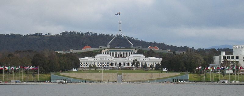
For Griffin’s design to be successful, it had to make good use of the landscape. This was achieved through the integration of the topography of the area into their design. This was as opposed to avoiding it. The grand central lake, for example, satisfied part of the design. Another aspect of the design was the fact that the city was placed in between the two mountains. These were Mount Ainslie and Mount Bimberi. This collective picture enhanced the street layout. It also conveyed civic power. This design was worth the price since it exploited the existing natural surrounding to depict democracy.
Transport in Paris – Velo Liberté
Introduction
Transport in Paris had been an issue for a long time due to the large number of vehicles entering and leaving Paris daily. This had caused the pollution level in Paris to increase tremendously. This led to the introduction of the Velib system (Susan and Stacey, 2011).
The reason why they use Velib
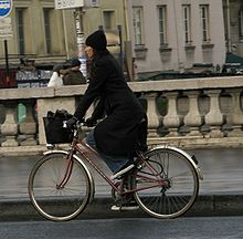
The public-private Velib bike initiative was initiated in order to encourage people to avoid the use of vehicles use bikes and public transport instead. This was meant to encourage the development of a unique popular culture.
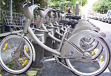
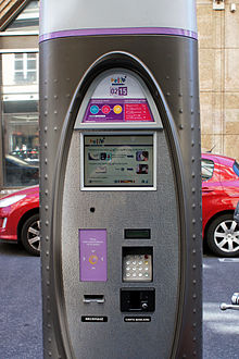
This culture is characterized by its language, jokes and other such stuff. It has been very successful and this has been an inspiration to other nations. They have also adopted similar programs in their own nations. Since the main mode of transportation is cycling, this has had a great effect on the effects of pollution and the issue of traffic. The effects go beyond the quantitative effects. The Parisians are socializing more and exercising more as they move around.
The way the Velib station works is quite simple. One only needs to take a bike and return it wherever one desires. It is a self-service bike system available at any hour of the day. One only needs to buy a ticket online. This may be a 1-day or a weekly ticket. Long-term sign-ups are also available.
Bogota – building a sustainable city
Introduction
This is the capital city of Colombia. It is also the largest and most populous city in that nation. The basic architectural design of the city has been maintained for centuries. The design that was put in place by the colonialists is still present to date.
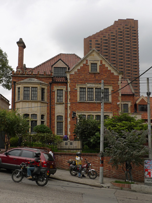
This is, particularly in La Candelaria. The colonial houses, which were two-storeyed buildings, have also been preserved. They were designed with gabled roofs and courtyards. They also had ceramic tiles and balconies. In some buildings, the balconies had glasses filled on them. This was a design popular during the republican period.
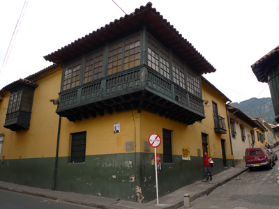
It was the distinguishing feature in the architectural design of that period. An example of building that has this architectural design in the House of Rafael Pombo. Bogota was recognized for its innovations, particularly in the transport system. It also showed efforts towards social inclusions, housing and education. This explains why it won the Golden Lion Award.
The architectural development of the city
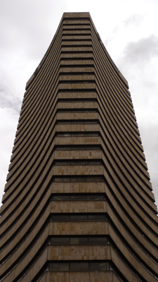
The republican architectural design was common between the years 1830 and 1930. There were also attempts to come up with a modern architectural language. James Daly designed buildings with this style. These include the University City and White City. The Bogotan architectural design was also adopted. These include the art deco and expressionism. This was the way to go during the mid-20th century. It includes the Rogelio Salmona. Although the city is well known for its preservation of the great colonial architectural techniques, it has also adopted contemporary architectural designs. An example of modern design can be seen in the north of the city.
Greatest cities of the world with Griff Rhys Jones – London
London city architecture
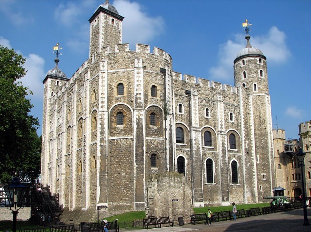
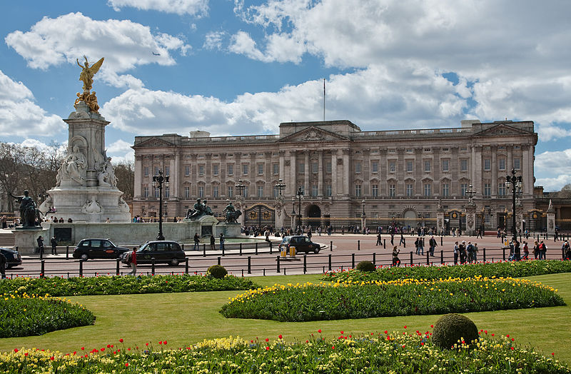
London cannot be characterized by one particular architectural design. This is because their buildings have been accumulated over a long time. Some of its structures date back to the 1600s – during the Great Fire. Examples include the Banqueting House, Westminster Abbey and the Tower of London. London contains many styles ranging from as late as the 17th century to the 21th century. The designs adopted from the 17th century include those of some churches and the financial institutions. Those of the 18th and 19th centuries include the Bank of England. The Royal Exchange also shows aspects of this design. The 20th-century designs have been used on such buildings as the Old Bailey. More modern buildings (21st century) include the Swiss Rebuilding. It is also known as the Gherkin.
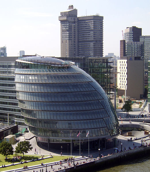
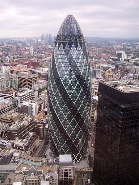
Griff Rhys Jones – London
Jones explored some aspects of some of the most exciting cities in the world. In his journey, he started with Rome. This city is more than 2000 years old. It hosts over 2.5 million inhabitants. Jones explored the world’s largest museum, which is located in Rome. He looked specifically at the lifestyles of the citizens living there. He also learned how traffic in the city’s busy roads is directed (Steven, 2008).
The architecture of Rome has transformed over the centuries. Its earliest styles included the Classical and Imperial Roman styles. These have transformed into modern Fascist architecture. Some of the famous works of the classical architecture include the vault, the dome and the arch (George, 1927). Other architectural styles used in Rome included the Romanesque, the Baroque and Renaissance architectural styles.
Transport and Portland – a sense of place
Introduction
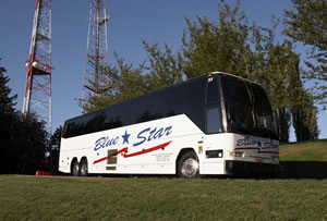
Portland has a great reputation due to its well-designed transport system. The transit-oriented development has earned it this reputation. This city’s public transport is well developed. The rail and bus systems serve three counties. These include Washington, Clackamas and Multnomah. Many of the city’s residents use public transit.
Transit-oriented development
The Portland’s city planners have transformed the city’s transport system into a global model of transit-oriented development. Initially, this area was only used for buses. However, major transformations have occurred. The city’s rail system is equally well developed. It consists of four color-coded lines. They represent the different destinations of the train. They include the blue, red, yellow and the green lines (Atkielski, 2012).
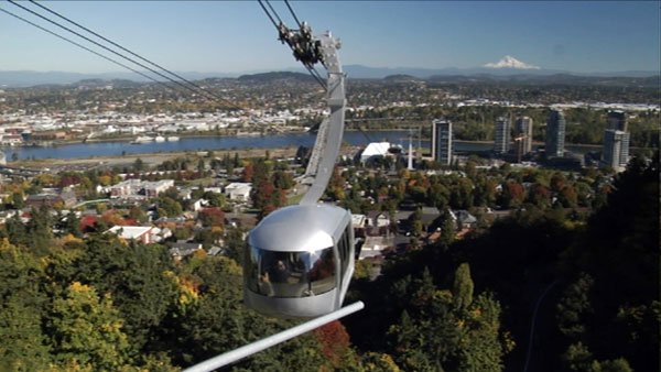
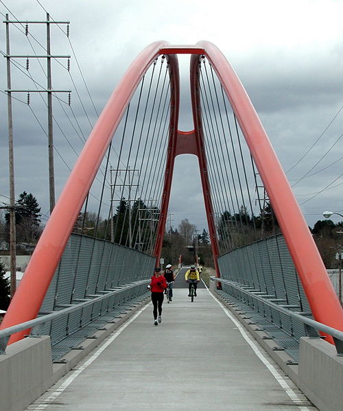
The city has also put in place aerial tramcars that connect the different locations. They are aerial cable systems that are meant to increase efficiency in transportation. There is also the use of bicycles. This has grown rapidly within the past eleven years. The master plan developed by the city planners included the pedestrian master plan. This was developed to provide proper access ways for the pedestrians. The city has various off-street trails and a street pedestrian bridge. The pedestrians and the cyclists can also use the Portland Aerial Tram. The city also has one-way roads with alternating street traffic. The transport system in Portland is a transformed transit-oriented development (Rivera, 2009).
Transport in Seoul – stream of consciousness
Introduction
The transport system in Seoul comprises air transport, road and rail. The road system includes the use of buses and taxis. The city also has well-developed subways and train systems. Seoul was set to transform its public transport system into a faster and more convenient one. This was meant to reduce confusion and to simplifier the passenger use. This was done through the use of four different colors (blue, green, red and yellow). The different colors represented the different functions. Bus numbering was also introduced in order to help passengers easily understand the routes and destinations of the buses.
Environmentally friendly transportation
Due to the harmful effects caused by diesel buses, there was the need for an environmentally friendly transportation system (Nikolaus, 1962). This led to the introduction of some eco-friendly buses including the CNG buses and electric buses. This was meant to reduce the effects of pollution due to the combustion of diesel in the engines.
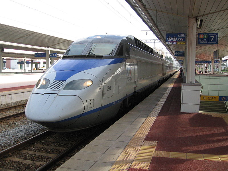
This led to the introduction of over 900 buses, which saw a great reduction in particulate matter. However, the CNG buses only reduced the exhaust gas from the buses but did not eliminate it completely. Therefore, this led to the introduction of electric buses. This led to the further reduction of GHG emissions by over 50%. The same line of thought was adopted for the taxi system in the region. The use of electric taxis was a great step towards environmental conservation. Such taxis travel longer distances while conserving fuel. Soule also has an established Scientistic Transport Management System. This includes the use of GPS systems, wireless communication networks and a traffic broadcasting system, among other innovative systems. Therefore, the transport system in Seoul observes both the environmental factor and efficiency.

Ottawa – Canada
Planning of Canada
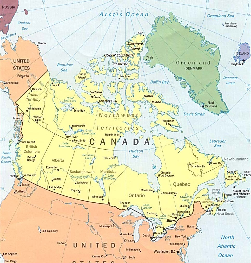
Canada is situated in the northern part of North America. It stretches from the Pacific Ocean to the Arctic Ocean. The country is divided into provinces and territories.
Architecture in Canada
The architecture used in Canada resembles that in the U.S. and Europe. However, there is a call for the need to adapt the Canadian design to the climate and geography of the area. The morphology of Canada is diverse and requires the use of different types of architecture. Canada is not at risk of damage caused by the major natural disasters like in the other nations. However, the climate in the area must be considered when it comes to setting up buildings and other structures. The area is characterized by extreme cold and long winters. Therefore, the building should have insulation in order to protect its inhabitants against the extreme weather conditions (Bailey et al., 1997).
The repeating cycles of freezing and thawing are not good for structures made of stone. This is because it can cause shattering or it may move the structure off its foundation. Another aspect that should be considered is the amount of snow falling in the area. Since there is heavy snowing at certain times of the year, the weight of the snow could collapse buildings. Therefore, the building should be able to sustain such great weights. Towards the coast, heavy rainfall is a factor that is taken into consideration when it comes to construction and architecture. This calls for weatherproof building.
References
Atkielski, A 2012, How to use public transport in Paris: A visitor’s guide to Parisian Mass Transit, Sage, New York.
Bailey, W, Oke T & Rouse, W 1997, The surface climates of Canada, McGill-Queen’s University Press, New York.
Fitzgerald, A 1987, Canberra in Two Centuries: A Pictorial History, Clareville Press, Australian Capital Territory.
George, H 1927, London, Dent & Sons, New York.
Gibbney, J 1988, Canberra 1913–1953, Australian Government Publishing Service, Canberra.
Gillespie, L 1991, Canberra 1820–1913, Australian Government Publishing Service, Canberra.
Nikolaus, P 1962, London I: The Cities of London and Westminster, Routledge, London.
Rivera, D 2009, ‘Buses return to Portland’s revamped transit mall’, The Oregonian, vol. 4, no. 1, pp. 23-43.
Steven, E 2008, A New Fashion Catches On in Paris: Cheap Bicycle Rentals, Sage, New York.
Susan, S & Stacey, G 2011, ‘Worldwide Bikesharing’, Access Magazine, vol. 5, no. 39, p. 15.